
Country State | Language spoken District Osmanabad | |
 | ||
Map of Osmanabad
Osmanabad pronunciation (transliterated in Marathi as Usmanabad) is a city and a municipal council in Osmanabad district in the Indian state of Maharashtra. Osmanabad derives its name from the last ruler of Hyderabad - H.E.H Mir Osman Ali Khan
Contents
- Map of Osmanabad
- Heavy rain in osmanabad city 2015
- Osmanabad city closed due to farmers strike
- History
- Geography
- Demographics
- Education
- Monuments and Attraction
- Dargah
- Dharashiv Caves
- Yedshi Ramling Wildlife Sanctuary
- Air
- Rail
- Road
- References
Heavy rain in osmanabad city 2015
Osmanabad city closed due to farmers strike
History
The city Osmanabad derives its name from the last ruler of Hyderabad - the 7th Nizam- H.E.H Mir Osman Ali Khan, of which the region was a part till 1947. Osmanabad's history dates way back to the era of the Ramayana where Lord Rama is said to have spent some of his exile in parts of Osmanabad. As per historical evidence, the district was ruled by the Mauryas, Satavahanas, Rashtrakutas, and Yadavas. In early centuries the city belonged to the Hindu Chalukyas and Devagiri Yadavas, but later became a part of the Bahmani and Bijapur kingdoms.
For a period of time, it was also ruled by the Mughals, Bahmani, Nizam and Adil Shah kingdoms. Before the Hyderabad Nizam's rule, it was under control of the Mughal King Aurangzeb. Being under the Nizam rule, the district did not celebrate its freedom when the rest of India became independent in 1947. However, soon in 1948, Hyderabad State was merged with independent India and the district became a part of the then Mumbai District. It became a part of Maharashtra State when the State was formed in 1960. Osmanabad has a historic lineage dating back to the days of Marathwada and even before that to several kingdoms of which the region was a part. Old name of Osmanabad is Dharashiv. As the city was called Dharashiv, the caves are situated outside the city are also named Dharashiv Caves. Osmanabad is famous for its religious shrines for Hindus, Buddhist, Jains and other communities and places of historical importance as well.
Geography
The city of Osmanabad has an elevation of 653 metres (2,142 ft). Osmanabad city is located in the west central part of Osmanabad Tahsil, but relatively central for the district as a whole. Tuljapur, Bhoom, Paranda, Washi, and Kalamb are the nearby towns. Solapur, located southwest of Osmanabad in Solapur district, is the nearest sizable city.Osmanabad is on Balaghat Pathar. Bhogavati river flows through the city & meets Sina River near Mohol in Solapur district.
Demographics
In the 2011 Indian census, the city of Osmanabad had 106,644 inhabitants, with 41,982 males (52.1%) and 38,643 females (47.9%), for a gender ratio of 920 females per thousand males. In 2001, Osmanabad had an average literacy rate of 74%, higher than the national average of 59.5%, male literacy was 80%, and female literacy was 67%. In 2001 in Osmanabad, 14% of the population was under 6 years of age.
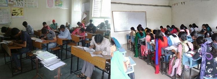
Education
Osmanabad has one Government BAMS College Known As Ayurvedic College, one Government Polytechnic College, Osmanabad Known As GPO, One Private Pharmacy College and Three Private Engineering Colleges. Another engineering college in Osmanabad District is in Tuljapur.The Most Popular College Of Obad City Is R.P College Known As Ramkrishna Paramhans Mahavidyalaya. Osmanabad has Government Agriculture college (under Marathwada Agriculture University, Parbhani) near Ter.
Osmanabad also has a sub-centre of Dr. Babasaheb Ambedkar Marathwada University, Aurangabad, which includes Department of Management Science, Department of Education, Department of Chemistry, Department of Biotechnology & Department of microbiology etc. In Osmanabad Shri Tuljabhavani Sainiki Vidyalay and Shripatrao Bhosale Highschool is well known school for students across Osmanabad district. Arya Chanakya High School, Shree.Chhatrapati Shivaji High School Are Also Good Schools For Kids Education.
Monuments and Attraction
Osmanabad is known for Dharashiv Caves, which were built during the 5th-7th century It was initially thought that the Buddhist caves were one of the earliest structures, created between the fifth and eighth centuries, dargah (Sufi shrine built over the grave of a revered religious figure) of Hazrat Khwaja Shamsoddin Gazi (RA). The interior decoration of the dargah, consisting of many colourful glass pieces, is the main attraction of the dargah nowadays. Osmanabad city has Hatladevi mandir which is big religious attraction for people in Osmanabad city.
Dargah
A dargah (Sufi shrine is in the city built over the grave of a revered religious figure) of Hazrat Khwaja Shamsoddin Gazi (RA). The interior decoration of the dargah, consisting of many colourful glass pieces, is the main attraction of the Dargah. The Urs of Hazarat Kwaja Shamshoddin Gazi festival celebrates in city in the month of Rajjab of Islamic calendar.
Dharashiv Caves
The Dharashiv caves are situated 8 km away from Osmanabad City in Balaghat Mountains. There are a total of 7 caves in the Mountain range. The first cave is without any statue with a small open space .The second cave consists of a statue with artistic work on the right side of the statue. The art work is of the Gandharva era. The fourth cave is an open space without any statue inside. The statue in the sixth cave is damaged while the seventh cave has no statue.
That this is an ancient place is shown by the caves excavated in the hill at a distance of about eight miles. These caves were originally Buddhist, but were later converted into monuments of the Jain religion and fresh caves were also excavated nearby. There are some more Buddhist caves that have been excavated in the hills, about 8 miles from Osmanabad city. The earliest of them probably belongs to the 7th century AD. Cave No. II is modeled on the plan of the Vakataka cave at Ajanta caves. It has a central hall measuring 80 feet by 80 feet, with 14 cells for the residence of the Bhiksus and garbhagriha with a colossal image of Lord Buddha in Padmasana. From the hoods of a serpent spread over its head, it is supposed to be the image of the Jain Tirthankara Parashvanath, but the figures of deer with a dharmachakra between them on the pedestal indicates that it is that of Gautama Buddha.
Yedshi Ramling Wildlife Sanctuary
Yedshi Ramling Wildlife Sanctuary is situated in the villages of Yedshi, Wadgaon and Bhanasgaon near to Osmanabad city which is situated in the Balaghat range. Yedshi is considered to be the Matheran of the district of Osmanabad. Yedshi is considered as a possible hill station-cum-health resort. It is a railway station on the Miraj-Latur broud gauge railway.
The only object of interest nearby is the temple of Ramling. Situated at a distance of about two miles from Yedshi, Ramling was a railway station on the Miraj-Latur narrow gauge section of the South-Central Railway. The temple is located in a ravine and is to such a depth that the spire of the temple is not visible from a distance and also after reaching the entrance gate of the temple. To reach the temple one has to descend a number of steps down below. The temple has an open courtyard with a sabhamandap and a pindi of Shankar is placed in an inner chamber. Many devotees throng the temple on every Monday in the month of Shravana. An annual fair is held in honour of Shri Ramling on Margashirsha Shuddha 4 and 5 (November–December). More than five thousand people assemble here at the time of the fair. In the temple of Ramling is also a shrine of Jatayu.
The place is also revered as it is considered to be the spot where Jatayu attacked Ravana, the king of Lanka, while he was carrying away Sita by force. Jatayu lost the battle and died at the hands of Ravana.
Dry deciduous forests occupy the area. Wildlife species include Chinkara, Hyena, Wolf, Wild bear, Fox, Black buck, Hares and Peacock. More than 100 species of birds are also found. The best time to visit is October to June.
Air
Osmanabad Airport (IATA: OMN) lies approximately 13 kilometres (8.1 mi) from the city centre. There are no scheduled commercial air services to this airport. It takes about 15-20 mins to reach airport by car from the bus stand. Maharashtra Industrial Development Corporation has leased the airport to Reliance Airport Developers Ltd. for 95 years. Reliance paid Rs. 63 crore for the deal, which includes other four airports of Maharashtra. The nearest operational airport Aurangabad Airport.
Rail
Osmanabad railway station (station code UMD) is an important railway station situated on Latur - Miraj railway route of central railway. Before 2004, a narrow gauge track connecting Latur to Kurduvadi passed through Osmanabad district. The station nearest to the city at Yedshi was 18 km away from Osmanabad City. During conversion from narrow gauge to Broad Gauge, the track alignment was changed and directed towards Osmanabad city. In the first stage, the broad gauge track between Latur-Osmanabad was completed and became functional in 2007. The first train to arrive at Osmanabad railway station was the Mumbai-Osmanabad Express that ran via Aurangabad and Manmad. The Osmanabad-Kurudvadi section was completed and made functional in 2008. Latur-Osmanabad-Mumbai Express was started via Kurduvadi, Pune in 2008. Osmanabad railway station come under Solapur mandal of Central Railway (CR) zone.
Osmanabad has connections to Pune, Mumbai, Kolhapur, Miraj-Sangli, Pandharpur, Nagpur, Parbhani, Latur, Nanded, Parali Vaijnath, Hyderabad, and Nizamabad.
Road
National Highway 9 and National Highway 211 (India)(old numbering)pass through the district. National highway 211 connects Osmanbad to other major cities of Maharashtra.