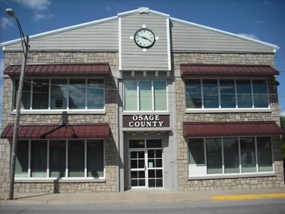
Area 1,582 km² Population 13,688 (2013) | Website osagecountygov.com Founded 1841 Unemployment rate 3.9% (Apr 2015) | |
 | ||
University Linn State Technical College | ||
Osage County is a county in the central part of the U.S. state of Missouri. As of the 2010 census, the population was 13,878. Its county seat is Linn. The county was organized January 29, 1841, and named from the Osage River.
Contents
- Map of Osage County MO USA
- Geography
- Adjacent counties
- Major highways
- Demographics
- Public schools
- Private schools
- Post secondary
- Local
- State
- Federal
- Missouri Presidential Preference Primary 2008
- References
Map of Osage County, MO, USA
Osage County is part of the Jefferson City, MO Metropolitan Statistical Area. Its geography and the founding of Westphalia Vineyards links it to the Missouri Rhineland, extending along the Missouri River valley to the western edges of the St. Louis Metropolitan Area. Westphalia Vineyards, although started only in 2005, won the gold medal in the National Norton Festival Wine Competition in St. Louis in 2007 for the top-rated wine from the Norton grape.
According to data from the 2010 census, Osage County is the whitest county in Missouri, with 98.85 percent of residents being white.
Geography
According to the U.S. Census Bureau, the county has a total area of 610 square miles (1,600 km2), of which 604 square miles (1,560 km2) is land and 6.1 square miles (16 km2) (1.0%) is water.
Adjacent counties
Major highways
Demographics
As of the census of 2000, there were 13,062 people, 4,922 households, and 3,578 families residing in the county. The population density was 22 people per square mile (8/km²). There were 5,904 housing units at an average density of 10 per square mile (4/km²). The racial makeup of the county was 98.64% White, 0.16% Black or African American, 0.24% Native American, 0.08% Asian, 0.02% Pacific Islander, 0.07% from other races, and 0.80% from two or more races. Approximately 0.59% of the population were Hispanic or Latino of any race.
There were 4,922 households out of which 34.90% had children under the age of 18 living with them, 61.70% were married couples living together, 6.70% had a female householder with no husband present, and 27.30% were non-families. 23.80% of all households were made up of individuals and 10.80% had someone living alone who was 65 years of age or older. The average household size was 2.61 and the average family size was 3.10.
In the county, the population was spread out with 26.30% under the age of 18, 9.50% from 18 to 24, 27.70% from 25 to 44, 21.70% from 45 to 64, and 14.70% who were 65 years of age or older. The median age was 36 years. For every 100 females there were 103.00 males. For every 100 females age 18 and over, there were 102.50 males.
The median income for a household in the county was $39,565, and the median income for a family was $46,503. Males had a median income of $29,538 versus $22,353 for females. The per capita income for the county was $17,245. About 5.90% of families and 8.30% of the population were below the poverty line, including 9.00% of those under age 18 and 10.40% of those age 65 or over.
Public schools
Private schools
Post-secondary
Local
The Democratic Party mostly controls politics at the local level in Osage County. Democrats hold a little over half of the elected positions in the county.
State
All of Osage County is a part of Missouri’s 112th District in the Missouri House of Representatives and is represented by Tom Loehner (R-Koeltztown).
All of Osage County is a part of Missouri’s 16th District in the Missouri Senate and is currently represented by Dan W. Brown (R-Rolla).
Federal
All of Osage County is included in Missouri’s 9th Congressional District and is currently represented by Blaine Luetkemeyer (R-St. Elizabeth) in the U.S. House of Representatives.
