
Parish of St-Joseph d'Orléans 1830's Community of Orléans 1974 Population 107,823 (2011) | Police Village of St-Joseph d'Orléans 1922 Time zone Eastern (EST) (UTC−5) Area code Area codes 613 and 343 Mayor Jim Watson | |
 | ||
Restaurants OCCO Kitchen, St Martha's Brasserie d'Orleans, OCCO Kitchen Innes, Moxie's Grill & Bar, Li's Fusion Hotels Holiday Inn Express Ottawa E, Quality Inn, Premiere Suites Ottawa | ||
Ottawa real estate orleans ontario rented
Orleans (/ɔːrˈliːnz/; French: [ɔʁleɑ̃]), (officially Orléans), is a suburb of Ottawa, Ontario, Canada. It is located in the eastern part of the city along the Ottawa River, about 16 km (9.9 mi) from downtown Ottawa. The Canada 2011 Census determined that Orleans' population was 107,823. Prior to being amalgamated into Ottawa in 2001, the community of Orleans was spread over two municipal jurisdictions, the eastern portion being in the pre-amalgamation City of Cumberland, the western portion in the City of Gloucester. According to the 2011 census, 62,888 people lived in the Cumberland portion of Orleans, while 44,935 people lived in the Gloucester portion. Today, Orleans spans the municipal wards of Orleans, Innes and Cumberland. Orleans is one of 3 areas of the post-amalgamated City of Ottawa to contain a significant francophone population, hence the community's name.
Contents
- Ottawa real estate orleans ontario rented
- Map of OrlC3A9ans Ottawa ON Canada
- Ottawa real estate chapel hill orleans ontario sold
- History
- Recreational facilities
- Neighbourhoods
- Population history
- English Catholic
- French Catholic
- French public
- English public
- Main roads and streets
- Highway 174
- References
Map of Orl%C3%A9ans, Ottawa, ON, Canada
Ottawa real estate chapel hill orleans ontario sold
History
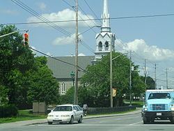
The community is thought to have been named by its first postmaster, Théodore Besserer, after his place of birth, the Île d'Orléans near Quebec City. Orleans was an incorporated police village from 1922 to 1974 and was then known as St. Joseph d'Orléans. The name corresponds to the main francophone Roman Catholic Church, Paroisse St-Joseph of which the older part of Orleans is built around, along St-Joseph Boulevard.
The community's name inspired the name of one its main roads, Jeanne D'Arc Boulevard, which wraps its way around the community. Jeanne d'Arc (Joan of Arc) was a 15th-century martyr who led the French army to victory in Orléans, France.
Largely a rural area for a great number of years, the first major suburban subdivision constructed in the community was the Queenswood Heights development starting in the late 1960s. Orleans has continued its steady growth as a suburban community since that time; its southern and easternmost boundaries continue to grow as more houses and businesses are built. Orleans continues to have a sizable French-speaking population, although the proportion of francophones has been decreasing in recent years. The community's name is spelled with an acute accent in French in the relevant regulation to the City of Ottawa Act, reflective of the area's francophone heritage.
Growth has focused around the Place d'Orléans shopping centre, a large shopping centre with over 175 stores situated off Ottawa Regional Road 174 (the Queensway). Place D'Orléans was originally constructed in 1979 and underwent major expansions in 1984, 1988, and 1990 to arrive at its current size and configuration. Many new business areas along Innes Road between Tenth Line Road and Mer Bleue Road and in the vicinity of Trim Road on the eastern end of the area have also been built recently which serve to diversify the commercial districts of the community. The country-wide housing boom starting from 2000 has also seen an extremely large amount of housing and residential areas being developed in the eastern Orleans area west of Trim Road and south of Innes Road, such as the new community called Avalon. The population and business growth also forced the improvement of Innes Road from a two-lane to a four-lane road in 2005.
Recreational facilities
The Elizabeth Manley skating rink at the Bob MacQuarrie Recreation Complex (formerly Orleans Recreation Complex) is named for figure skater Elizabeth Manley who trained there and who won a Silver Medal in Women's figure skating in the 1988 Calgary Winter Olympics. It is home to the Gloucester Skating Club and the Canadian Academy of Skating Arts. The skating club is well known for sending skaters to national and international level competitions. The Ray Friel Recreational Complex in the more eastern part of Orleans is home to a public library, a high school (Sir Wilfrid Laurier Secondary School), an indoor wave pool, exercising facilities, a physiotherapy clinic, a sports store, a restaurant, two soccer fields and three skating arenas making it one of the main centres for recreation in Orleans. In 2009, the Shenkman Arts Centre opened just east of Place d'Orléans. It is a multidisciplinary arts centre that houses a concert hall, black-box theatre, several art galleries and studio spaces for both visual and performing arts.
Along the Ottawa River in the north-east of Orleans, is the parkland of Petrie Island. The parkland is located on several small islands connected by Trim Road, a north-south roadway. The islands are sandbars developed over time in the river. There was a facility extracting sand from the islands, but this has been closed and converted into a large beach area. Petrie Island is home to turtles in some of its sheltered lagoons and has a nature centre for learning more about the local environment. One section of Petrie Island has several homes, but the area is mainly parkland. There is a marina with canoe and kayak rentals.
There are also several nature trails and paths throughout the area including the Bilberry Creek Trail and the Princess Louise Trail through which Taylor Creek runs and which results in a beautiful waterfall near St-Joseph Boulevard.
A memorial diorama by Bruce Garner was erected August 13, 2000 in the Memorial Park near Royal Canadian Legion, Branch 632 to remember those who have served Canada in wars and as Peace Keepers.
Neighbourhoods
Avalon: Located south of Innes Road, west of Portobello Boulevard and east of Tenth Line Road.
Bilberry Creek: Located east of Jeanne d'Arc Boulevard, north of Highway 174 and east towards the eastern end of the development.
Cardinal Creek: Located north of Innes Road, west of Cardinal Creek and St-Joseph Blvd. Western boundary overlaps with Fallingbrook.
Chapel Hill North: Located north of Innes Road in the Orléans Boulevard area and south of St-Joseph Boulevard.
Chapel Hill South: Located south of Innes Road, and north of Navan Road.
Chaperal: Located south of Innes Rd and north of Blackburn Hamlet Bypass, on Tenth Line Road.
Chateau Neuf: Is bounded by St-Joseph Boulevard on the north, Innes Road on the south. The eastern border includes Jeanne d'Arc-Sunview-Des Grives-Barsona-Place Belleterre-Duford Drive, and Orléans Boulevard borders the west.
Chatelaine Village: Located north of Highway 174 toward the Ottawa River and East of Willow Ave.
Convent Glen: Located north of Highway 174 toward the Ottawa River and west of Jeanne d'Arc Boulevard.
Convent Glen South: Located south of Highway 174 and north of St. Joseph Blvd and generally west of Orléans Blvd.
Eastridge [1]: Future community situated near Trim Road and Blackburn By-Pass Road south of Notting Gate community.
Fallingbrook: Located south of St-Joseph Boulevard, west of Trim Road, north of Innes Road and east of Tenth Line Road.
Hiawatha Park: Older neighbourhood on the Ottawa River, north of Convent Glen.
Mer Bleue (future): This proposed neighbourhood would be located south of Innes Road between Mer Bleue and Tenth Line Road and south towards the Urban limit.
Notre Dame Des Champs: Near Mer Bleue and Navan Road. Houses are built on bigger lots.
Notting Gate: Located south of Innes Road, east of Portobello Boulevard, and west of Trim Road.
Orleans Village: Oldest part of Orleans, located along St-Joseph Blvd between Orléans Blvd and Duford Dr.
Orleans Wood: Located north of Highway 174 toward the Ottawa River, east of Jeanne d'Arc Boulevard and west of Champlain Street.
Queenswood Heights: Located south of St-Joseph Boulevard, west of Tenth Line Road, east of Duford Road.
Queenswood Village: Older neighbourhood between Champlain St and Willow Ave, north of Highway 174.
River Walk: East of Tenth Line, north of Highway 174.
Population history
English Catholic
French Catholic
French public
English public
Queenswood Public School closed in 2008(now Coccinelle (Garderie) École La Source)
Main roads and streets
Highway 174
The main highway linking Orleans to central Ottawa to the west is officially known as Ottawa Regional Road 174 and forms part of the Queensway.