
Length 425 mi (684 km) Trail difficulty Easy to moderate | Use Hiking | |
 | ||
Trailheads Mouth of the Columbia River/California border | ||
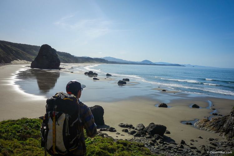
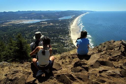
Oregon coast trail thru hike 01
The Oregon Coast Trail (OCT) is a long-distance hiking route along the Pacific coast of Oregon in the United States. It follows the coast of Oregon from the mouth of the Columbia River to the California border south of Brookings.
Contents
- Oregon coast trail thru hike 01
- Oregon coast trail
- Route
- Trail walking information
- Points of interest
- References
The trail was created by Oregon Recreation Trails Advisory Council and managed by the Oregon Parks and Recreation Department as part of the state park system of Oregon. The walking length of the trail varies depending on choice of passage across or around estuaries and rivers along the route. If a ferry is not arranged or available, an alternate route around the estuary must be taken; if traveling on foot, this means road walking. The length of the trail, using the Google Maps pedometer tool to measure route mileage, is about 425 miles (680 km) if no ferries are used, though the official coastal guide gives a length of 382 miles (615 km). If no ferries are used, about 39 percent of the route is on the beach, 41 percent is on paved road, and 20 percent is on trail and dirt roads.
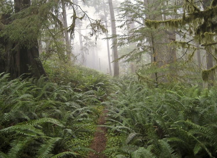
A chief feature of the trail are the public beaches created in 1967 via the Oregon Beach Bill, which formalized the public nature of the coastal beaches since the first such law was passed in 1913. Many of the locations, particularly on the southern portion, are remote and isolated. The Oregon coast is bordered by a temperate rainforest, much of which is now second or third growth.
The difficulty of the trail ranges from easy to moderate, with elevation changes of up to a few hundred feet.
Oregon coast trail
Route
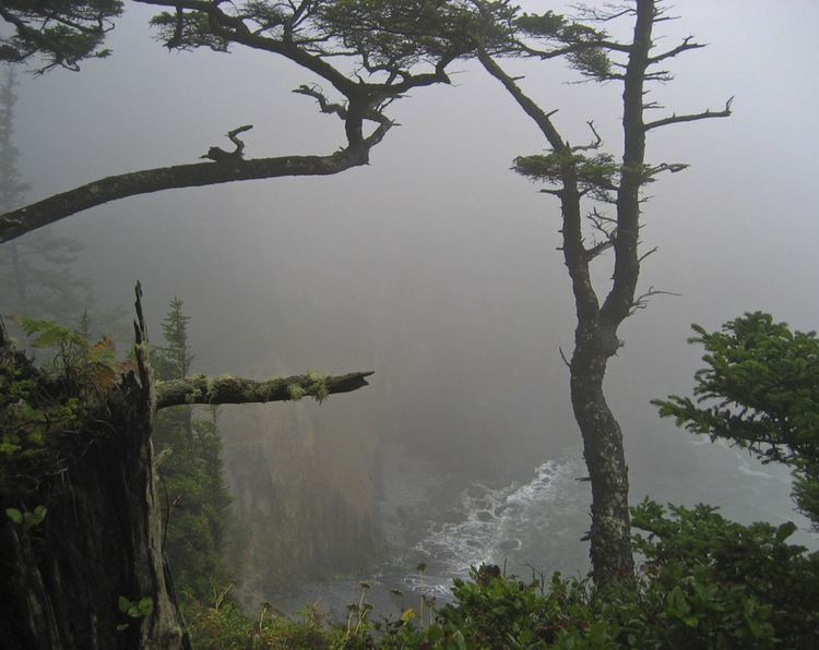
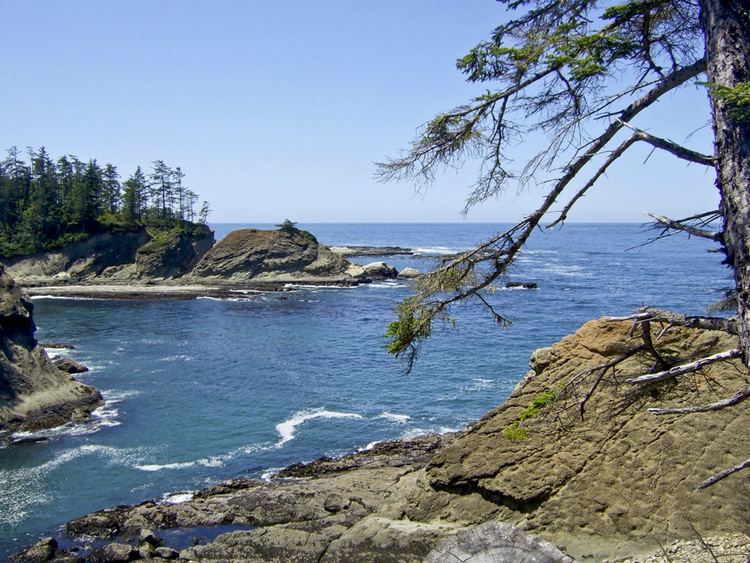
The northern trailhead is at the base of the south jetty of the Columbia River, approximately 4 miles (6 km) north of the campground of Fort Stevens State Park and about 13 miles (21 km) from the city of Astoria. The trail runs north-south along the entire Oregon Coast, following the shore as closely as practical. For many portions of the route, it is beach walking, mostly on sand. In populated areas it often follows the nearest street to the shore. Many parts of the trail leave the beach and take an inland path, usually where land formations make the shoreline impassable, such as at Cape Kiwanda. Some of the rocky headlands are passable on foot at beach level only at low tide. Other headlands are traversed by state park or forest service trails well above the sea. In many other places, the road is the only feasible route, mostly U.S. Route 101. The southern terminus of the trail is the unmarked Oregon/California border on a stretch of beach about 5 miles (8 km) south of Brookings, and about half a mile south of the Winchuck River.
Besides headlands, there are numerous rivers and creeks which must be crossed. Most creeks are forded by wading, although sometimes the water can be waist deep even at low tide. At high tide, some are hazardous or impossible to cross and require a boat or a detour to a bridge. Rainfall during winter and early spring decreases the number of streams which are safely fordable.
Trail-walking information
A dedicated guidebook for the OCT has not been published. In 2009, the State of Oregon posted a set of downloadable maps with brief route descriptions. Local Oregon hiking guidebooks have good descriptions of portions of the route, particularly for the trail segments. Updated route guides are published on a discussion group. A recently published descriptive trail guide can be accessed in the Links at the bottom of the page. The Oregon Coast Trail is a described route and not a continuous trail. More than 150 miles (240 km) of the route is on pavement. The OCT is signed throughout its length, but in some places signage is not reliable. However it is difficult to become lost since the route is never more than a few miles from a paved road.
The trail is open to hikers, and in some places, to bicycles, and equestrians. As portions of the route lead around headlands or cross river mouths that are only passable at low tide, carrying a current tide table and relevant topographic information can be extremely helpful. Sometimes a hiker must choose between waiting for a lower tide or walking inland to avoid high water.
Seasonal recreation restrictions are in place from March 15 through September 15 in some locations to protect shorebird nesting. These restrictions include complete prohibition of dogs, camping, non-motorized vehicles (including bicycles and fat bikes), motorized vehicles, and kites. Hikers and equestrians must also stay on the wet sand, including potty breaks or rest stops. Shorebird areas are clearly marked on the beach with yellow signs. Online maps are available from Oregon Parks and Recreation Department here: https://www.oregon.gov/oprd/NATRES/Pages/plover.aspx
Many state campgrounds have areas dedicated for hikers and bicyclists at reduced prices (compared to vehicles). Beach camping is allowed where out of sight of residences, not adjacent to state parks, and not near snowy plover during nesting season. This limits camping on some areas of the trail to developed campgrounds, particularly along the northern beaches. The State of Oregon has stated its intention to create more primitive and free camping areas.
Vehicles are allowed on a few beaches. Dune buggies are used extensively in the Oregon Dunes National Recreation Area, a 40-mile (64 km) stretch of beach from Florence to Coos Bay.
Several portions of the trail are pristine and secluded, such as the segment from Bandon to Port Orford, where several days of relative solitude and free camping exist.
Prevailing winds are from the northwest which makes the trail easier to hike from north to south. Route descriptions are also written assuming a north to south direction of travel.
Cities and towns of various sizes are located along Highway 101 every 20 to 25 miles (32 to 40 km) permitting re-provisioning on a regular basis. Public transportation is extremely limited along the coast.
Points of interest
Places found along the OCT from north to south.