
West end: Highway 2 – Eastwood Constructed 14 August 1935 | Length 76.5 km | |
 | ||
Existed: August 14, 1935 – April 1, 1997 Counties Oxford County, Brant, Hamilton | ||
King's Highway 53, commonly referred to as Highway 53, was a provincially maintained highway in the southern portion of the Canadian province of Ontario that connected Woodstock to Hamilton via Brantford. The route served as a southerly bypass to Highway 2, avoiding Paris, Ancaster and Hamilton.
Contents
First designated in 1935, the route remained in place until it was downloaded to local jurisdiction in 1997. For much of its history, the road was concurrent with Highway 2 between Woodstock and Eastwood, as well as between Brantford and Ancaster. Today the route is known by various local names, including Oxford County Road 55, Brant County Highway 53, Wilson Street, Garner Road and Rymal Road. It serves as a viable alternative to Highway 2 or Highway 403.
Route description
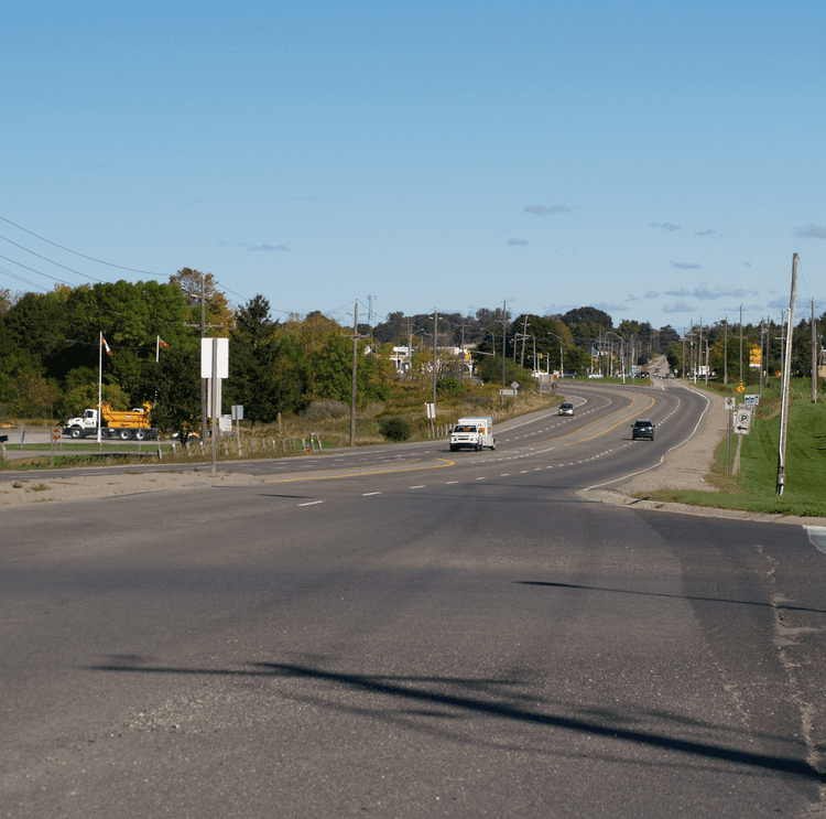
The route of former Highway 53 begins in the west at Oxford County Road 2, formerly Highway 2. From the community of Eastwood, which lies east of Woodstock, the road travels southwest through farmland as Oxford County Road 55 and crosses Highway 403, with which there is an interchange. Soon thereafter, the route enters the community of Muir, at the Oxford County and County of Brant boundary.
The route, east of this point known as Brant County Highway 53, continues southeast, passing through the community of Cathcart. It continues, eventually straightening out and travelling east through Burford. As the road approaches Brantford, it intersects Highway 24 (Rest Acres Road) and skirts the southern edge of Brantford Municipal Airport.
Within Brantford, the road is known as Colborne Street, although the section through downtown Brantford is a one-way street; westbound traffic is directed onto Dalhousie Street. The route crosses the Grand River west of downtown, intersecting and becoming concurrent with former Highway 2, now Brant County Highway 2, at Brant Avenue. It intersects the southern terminus Wayne Gretzky Parkway towards the eastern end of town and eventually crosses a Southern Ontario Railway track into the community of Cainsville. After returning to farmland, the route passes through the community of Langford and soon thereafter enters Hamilton.
History
Highway 53 was created in the mid-1930s to bypass the congested section of Highway 2 between Woodstock and Brantford. It was later extended into Hamilton to improve the layout of highways around that city, specifically Highway 20A.
On August 14, 1935, the Department of Highways (DHO) designated the Burford Road as Highway 53. The route entered Brantford along Burford Street, turning onto Oxford Street at Welsh Street and becoming concurrent with Highway 24 to cross the Grand River. On the opposite side, Highway 53 ended at Highway 2. Burford and Oxford streets have since been renamed as an extension of Colborne Street. At its western terminus, the route intersected Highway 2 in Eastwood, then travelled concurrently with it for 7.7 km (4.8 mi) west into Woodstock.
In 1937, a series of route renumberings took place in the Hamilton area. Among these was the renumbering of Highway 20A, which prior to then followed Upper Gage Avenue to Rymal Road. Rymal Road was also numbered Highway 20A from Duff's Corners, south of Ancaster, to Elfrida, at the junction of Rymal Road and Centennial Parkway. Following the renumbering, the route north into Hamilton became Highway 55, while Garner Road and Rymal Road became an extension of Highway 53. To connect the two sections of the route, a concurrency was established along Highway 2 between Brantford and Duff's Corners.
The highway was fully paved by 1939, though most sections of it were paved when it was first commissioned as a provincial highway. In 1954, the concurrency with Highway 2 near Woodstock was discontinued, establishing the western terminus at Eastwood. The route remained this way until the late-1990s.
In 1997, the remainder of Highway 53 was downloaded to Regional Municipality of Oxford County, Brant County, and the City of Hamilton (formerly the Regional Municipality of Hamilton-Wentworth). The road is now known as Oxford County Road 55, Brant County Highway 53, and Brant County Highway 2/53 (for being co-signed with fellow defunct road Highway 2). In Hamilton, the road is simply known as Rymal Road and Garner Road.
Rymal Road is named after William Rymal, (1759–1852), farmer and one of earliest settlers on the Hamilton mountain.
Major intersections
The following table lists the major junctions along Highway 53, as noted by the Ministry of Transportation of Ontario. In addition, it includes some minor junctions.