
 | ||
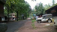
Olayambadi is a small village about 20 km from Payyanur town in the Kannur district of Kerala state, South India.
Contents
Map of Olayambadi, Kerala 670306
Temples
The famous Meenkulam Sree Krishna Temple is situated here.Village/hamlet in Payyannur Taluk in Kannur District of Kerala State, India. It comes under Kuttoor Panchayath. It belongs to North Kerala Division . It is located 38 km towards North from District headquarters Kannur. 521 km from State capital Thiruvananthapuram
Location
Olayambadi is surrounded by Taliparamba Taluk towards East, Nileshwar Taluk towards North, Kanhangad Taluk towards North, Kannur Taluk towards South . Payyannur, Cheruthazham, Kalliasseri, Taliparamba are the nearby Cities to Olayambadi.
→ It is near to Arabian sea. There is a chance of humidity in the weather.
Language
Malayalam is the Local Language here.
Transportation
The national highway passes through Perumba junction. Goa and Mumbai can be accessed on the northern side and Cochin and Thiruvananthapuram can be accessed on the southern side. The road to the east of Iritty connects to Mysore and Bangalore. The nearest railway station is Payyanur on Mangalore-Palakkad line. Trains are available to almost all parts of India subject to advance booking over the internet. There are airports at Kannur, Mangalore and Calicut. All of them are international airports but direct flights are available only to Middle Eastern countries.
Postal codes
Pincodes near Olayambadi
671311 ( Elambachi ), 670327 ( Edat ), 670307 ( Payyanur )