
Area 225.5 km² Local time Thursday 11:14 PM | Region Kantō Phone number 042-557-0501 Population 5,177 (Feb 2016) | |
 | ||
Address 215-6 Hikawa, Okutama-machi, Nishitama-gun, Tokyo 198-0212 Weather 2°C, Wind W at 11 km/h, 94% Humidity Points of interest Kawanoriyama, Mt Mito, Okutama Shuyu Road, Okutama "Mukashi Michi", Mt Takanosu | ||
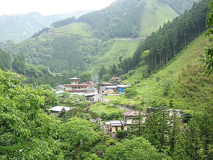
Okutama (奥多摩町, Okutama-machi) is a town located in the western portion of Tokyo Metropolis, in the central Kantō region of Japan. As of 1 February 2016, the town had an estimated population of 5,177 and a population density of 23 persons per km². Its total area was 225.53 square kilometres (87.08 sq mi). With an area of 225.63 km2
Contents
- Map of Okutama Nishitama District Tokyo Japan
- Geography
- Mountains
- Rivers
- Lakes
- Surrounding municipalities
- Prehistory
- Premodern period
- Modern Times
- Economy
- Education
- Railway
- Bus
- Highway
- Sister city relations
- Local attractions
- References
Map of Okutama, Nishitama District, Tokyo, Japan
Geography
Okutama is located in the Okutama Mountains of far western Tokyo. It is geographically the largest municipality in Tokyo. Mount Kumotori, Tokyo's highest peak at 2017 m, divides Okutama from the Okuchichibu region of the neighboring Saitama and Yamanashi Prefectures. Tokyo's northernmost and westernmost points lie in Okutama, as does Lake Okutama, an important source of water for Tokyo, situated above the Ogōchi Dam in the town.
Mountains
Rivers
Lakes
Surrounding municipalities
Prehistory
People began settling in Okutama from before the Jomon Period and many archaeological sites have been found with ancient pottery. During the Yayoi Period, rice cultivation began in the flatter lands of present-day Okutama, but most of the area remained. covered by forests and only small flat lands existed.
Premodern period
During the Edo Period, the area included in present-day Okutama was divided into 16 villages within Musashi Province. In each village, there was one person who served as the mayor, another who served as the leader of a particular group, and another who served as a representative for the farmers. Also, entering Mount Takanosu was forbidden for people of low rank during this time. This was because the people of high rank (government officials and such) hunted with hawks at the mountain, and the officials wanted to keep the hunting grounds for themselves.
Modern Times
With the start of the Meiji period, the area of Okutama became part of Nirayama Prefecture except for Kotaba village, which was merged into Maebashi Domain, which then became part of Gunma Prefecture. While Kotaba village was turned into part of Maebashi city, the Okutama area was divided into three villages of Hikawa, Kori, and Ogouchi with the establishment of the municipalities system on April 1, 1889. In 1940, Hikawa was elevated to town status. In 1955, Hikawa town, Ogouchi village and Kori village were united, forming the town of Okutama.
Economy
Seasonal tourism, forestry and charcoal production are mainstays of the local economy.
Education
Okutama has two elementary and two middle schools. The town does not have a high school.
Railway
The East Japan Railway Company serves the town. The Ōme line, which connects the town with Tachikawa, terminates at Okutama Station.
Bus
The Nishi Tokyo Bus Co. carries passengers to Lake Okutama, the Nippara Limestone Cave, Tabayama village and Kosuge village (both in Yamanashi Prefecture) from Okutama Station.
Highway
Sister city relations
Local attractions
All of the town is located in Chichibu-Tama-Kai National Park.