
Existed: 1970 – present Length 122.2 km | Constructed 1970 | |
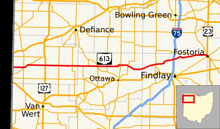 | ||
State Route 613 (SR 613) is an east–west state highway in the northwestern portion of the U.S. state of Ohio. Its western terminus is at the Indiana state line 4 miles (6.4 km) west of Payne (the route once continued west in Indiana as State Road 14), and its eastern terminus is at US 23 in Fostoria.
Contents
Map of OH-613, Ohio, USA
Route description
From the Indiana state line, State Route 613 follows a generally easterly direction through small towns such as Payne, Oakwood, and Continental. It shares a route with State Route 634 for 2 miles (3.2 km) before entering Continental. After Continental, the route continues east into Leipsic, then into McComb, where it shares a route with State Route 235 for a short distance.
It continues in an eastern direction, drifting north, through Van Buren, until it meets State Route 18 south of Bloomdale. State Route 613 and State Route 18 run concurrently for 10 miles (16 km), heading into Fostoria. When the routes meet up with US 23 and SR 199 in Fostoria, SR 18 continues south along US 23 and SR 199 while SR 613 ends.
History
From 1938 to 1943
In Fostoria, SR 613 formerly continued east of US 23 and SR 199 along North Avenue and North Poplar Street before ending at SR 12. In 2012, the City of Fostoria and ODOT proposed removing this segment of SR 613 from the state highway system due to the narrow streets with the aim of reducing truck traffic through the city.