
Existed: 1937 – present Length 15.56 km | Counties: Sandusky Constructed 1937 | |
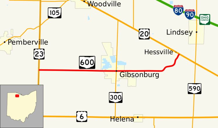 | ||
State Route 600 (SR 600) is an east–west state highway in the northwestern portion of the U.S. state of Ohio. The western terminus of State Route 600 is at US 23 about 5 miles (8.0 km) west of Gibsonburg. Its eastern terminus is at US 20 in the unincorporated community of Hessville approximately 4.25 miles (6.84 km) east of Gibsonburg.
Contents
Map of OH-600, Gibsonburg, OH 43431, USA
Route description
All of SR 600 exists within the confines of Sandusky County, though at the western terminus, US 23 straddles the Sandusky–Wood County boundary. This highway is not included within the National Highway System, a system of highways deemed most important for the country's economy, defense and mobility.
History
SR 600 was first designated in 1937 along the routing that it maintains today between US 23 and US 20. No significant changes have taken place to the routing of the state highway since its inception.
Major intersections
The entire route is in Sandusky County.