
Existed: 1964 – present Counties: Wayne Constructed 1964 | Length 21.68 km | |
 | ||
South end: SR 302 in Chester Township | ||
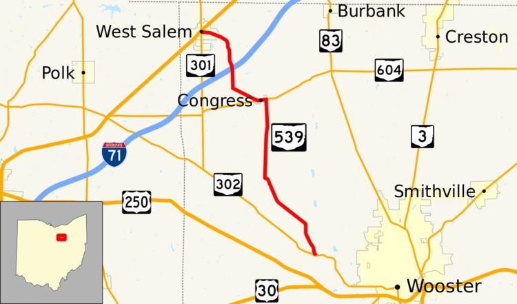
State Route 539 (SR 539) is a north–south state highway in the northeastern quadrant of the U.S. state of Ohio. State Route 539 has its southern terminus at State Route 302 in Chester Township approximately 3 miles (4.8 km) northwest of the city limits of Wooster. Its northern terminus is at its junction with State Route 301 in West Salem, just one block south of that route's junction with U.S. Route 42.
Contents
Map of OH-539, Ohio, USA
Route description
The entirety of State Route 539 is situated within the northwestern portion of Wayne County. There is no segment of this route that is included within the National Highway System, a network of highways deemed to be most important for the country's economy, mobility.
History
State Route 539 was designated in 1964. The route was established along the alignment that it utilizes to this day between State Route 302 near Wooster and State Route 301 in West Salem. No changes of major significance have taken place to State Route 539 since its inception.
Major intersections
The entire route is in Wayne County.