
Length: 0.74 mi (1.19 km) | Existed: 1970 – present | |
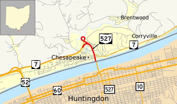 | ||
State Route 527 (SR 527) is a north–south state highway in the southern portion of the U.S. state of Ohio. Its southern terminus is at the Ohio River in Chesapeake, where the Robert C. Byrd Bridge carries travelers across to Huntington, West Virginia. Its northern terminus is at State Route 7 at the partially completed Chesapeake bypass just northeast of the Chesapeake corporation limits. The Route is only signed at the southern end of the SR 7 concurrency; a signalized intersection. State Route 527 is one of the few state routes in Ohio that connects to the same numbered route in a neighboring state, becoming West Virginia Route 527.
Contents
Route description
None of SR 527 in Ohio is included as a part of the National Highway System (NHS). The NHS is a network of highways that are identified as being most important for the economy, mobility and defense of the nation.
SR 527 heads north from the southern terminus as a four–lane highway. The route begins a concurrency with SR 7 at a traffic light. The northern terminus of SR 527 is at an interchange with SR 7, with SR 7 heading southwest.
History
From 1938 to 1941
Major intersections
The entire route is in Chesapeake, Lawrence County.