
Existed: 1934 – present Constructed 1934 | Length 29.48 km | |
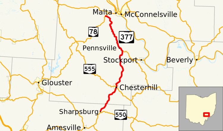 | ||
State Route 377 (SR 377) is a north–south state highway located in southeastern Ohio, a U.S. state. The southern terminus of State Route 377 is at State Route 550 approximately 4 miles (6.4 km) northeast of Amesville. Its northern terminus is at State Route 78 nearly 2 miles (3.2 km) southwest of Malta.
Contents
Map of OH-377, Ohio, USA
Route description
State Route 377 runs through portions of Athens and Morgan Counties. No part of this highway is incorporated within the National Highway System.
History
When the former State Route 77 was re-routed to the east of McConnelsville along what is now State Route 60 in 1934, the former stretch of State Route 77 between the former U.S. Route 50N (now State Route 550) northeast of Amesville and State Route 78 southwest of Malta was re-designated as State Route 377. Since that time, there have been no changes of major significance to the routing of this state highway.