
Existed: 1934 – present Constructed 1934 | Length 39.8 km | |
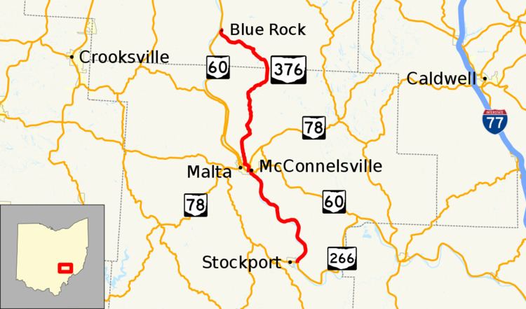 | ||
State Route 376 (SR 376) is a north–south state highway in the southeastern portion of the U.S. state of Ohio. SR 376 has its southern terminus at a T-intersection with SR 266 just across the Muskingum River from Stockport. Its northern terminus is at SR 60 in the unincorporated community of Blue Rock.
Contents
Map of OH-376, McConnelsville, OH 43756, USA
Route description
The path of SR 376 takes it through parts of the counties of Morgan and Muskingum. This route is not included as a part of the National Highway System.
History
SR 376 was designated in 1934. Originally, the highway ran from its current southern terminus at SR 266 near Stockport to the former SR 77 (now SR 60) in McConnelsville. In 1937, SR 637 was extended north of McConnelsville along a previously un-numbered roadway up to a new northern terminus at SR 340 in the hamlet of Ruraldale. By 1964, SR 340 was truncated to its current western terminus at SR 284. The portion east of SR 376 would become known as county-maintained Ruraldale Road, while the portion to the west would become an extension of SR 376 that would take it to its current northern terminus at SR 60 in Blue Rock.