
Existed: 1935 – present Length 51.89 km | Constructed 1935 | |
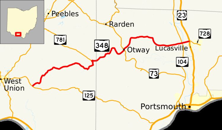 | ||
State Route 348 (SR 348) is an east–west state highway in the south central portion of the U.S. state of Ohio. Its western terminus is at State Route 125 approximately 6 miles (9.7 km) east of West Union, and its eastern terminus is at U.S. Route 23 just north of Lucasville – this is also the western terminus of State Route 728.
Contents
Map of OH-348, Ohio, USA
History
SR 348 was commissioned in 1935, routed on its current route, with the eastern terminus at its intersection with SR 73 in Otway. In 1939 the route was extended east to U.S. Route 23, near Lucasville.
References
Ohio State Route 348 Wikipedia(Text) CC BY-SA