
Existed: 1930 – present Constructed 1930 | Length 28.02 km | |
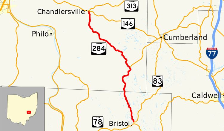 | ||
State Route 284 (SR 284, OH 284) is a north–south state highway in east central Ohio, a U.S. state. State Route 284 has its southern terminus is at State Route 83 approximately 8 miles (13 km) northeast of McConnelsville, and just 0.25 miles (0.40 km) north of the western split of the concurrency State Route 83 has with State Route 78. The northern terminus of State Route 284 is at a T-intersection with State Route 146 in the unincorporated community of Chandlersville. A portion of SR 284 is part of the Morgan County Scenic Byway.
Contents
Map of OH-284, Ohio, USA
Route description
State Route 284 runs through portions of Morgan and Muskingum Counties. No portion of this state highway is included within the National Highway System.
History
The year 1930 marked the debut of State Route 284 in the Ohio state highway system. Routed at inception along the path that it currently occupies, State Route 284 has not experienced any significant changes.