
Existed: 1935 – present Length 29.1 km | Counties: Monroe Constructed 1935 | |
 | ||
Ohio state route 255 part 1 of 2 near woodsfield to sardis twisty
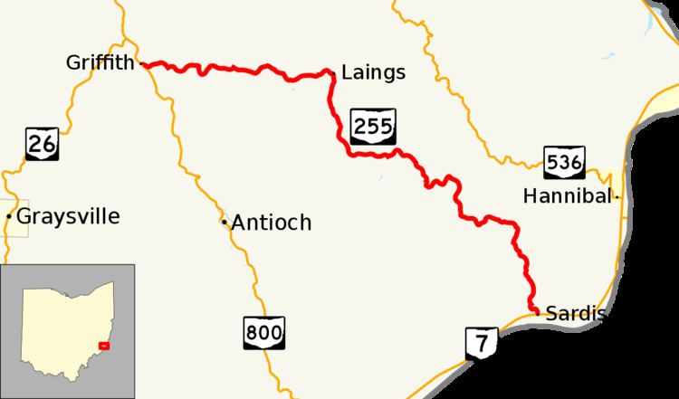
State Route 255 (SR 255) is an east–west state route located in southeast Ohio. Nestled entirely inside the southeast quadrant of Monroe County, the western terminus of State Route 255 is at a T-intersection with State Route 800 approximately 3 miles (4.8 km) south of Woodsfield. Its eastern terminus is at State Route 7 in the hamlet of Sardis, which is situated along the banks of the Ohio River.
Contents
- Ohio state route 255 part 1 of 2 near woodsfield to sardis twisty
- Map of OH 255 Ohio USA
- History
- Major intersections
- References
Map of OH-255, Ohio, USA
History
SR 255 was commissioned in 1935 on the same alignment as it currently occupies. Paving of the route between SR 800 and the Little Muskingum River was completed between 1957 and 1959. The rest of the route was paved by 1961.
Major intersections
The entire route is in Monroe County.
References
Ohio State Route 255 Wikipedia(Text) CC BY-SA