
Existed: 1924 – present Length 58.97 km | Constructed 1924 | |
 | ||
Counties | ||
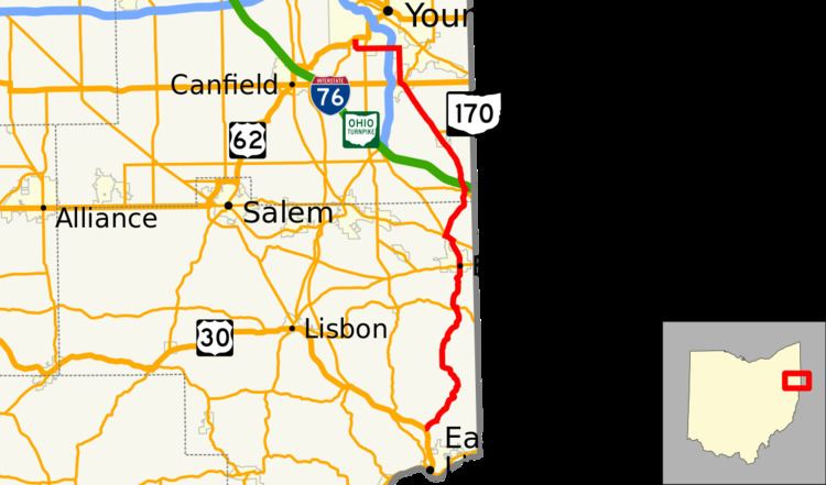
State Route 170 (SR 170) is a north–south running state route located in Mahoning and Columbiana counties in northeast Ohio. It runs within a few miles of the Pennsylvania border for much of its route as it passes though the eastern parts of the two counties. The southern terminus is at an interchange with U.S. 30, State Route 7, and State Route 11 near Calcutta, and the northern at U.S. 62 in Youngstown. ODOT extended the northern terminus from the previous point of Interstate 680, changing signs on July 16 and 17, 2008.
Contents
1924
Original state highway.
1924
Originally routed from East Palestine to Petersburg.
1931
Extended to East Liverpool along previous unnumbered road.
1962
Extended to 1-mile (1.6 km) north of North Kingsville along previous route 90.
1970
Truncated at 3 miles (4.8 km) north of Poland.
2008
Extended 3 miles (4.8 km) to U.S. 62 in Youngstown along the former Route 625.