
Existed: 1923 – present Constructed 1923 | Length 52 km | |
 | ||
East end: Taggart Road to PA 51 / Constitution Boulevard at the Pennsylvania state line near East Palestine Counties | ||
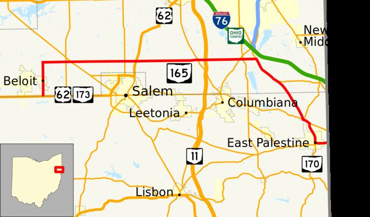
State Route 165 (SR 165) is a 32-mile (51 km) long, primarily east–west running state route located in Mahoning and Columbiana counties in northeast Ohio. The route runs through generally rural sections of southern Mahoning County, and serves East Palestine in extreme northeast Columbiana County. The route connects quite a few unincorporated villages in southern Mahoning County as it passes through. The western terminus is at U.S. Route 62 and State Route 173 just south of Beloit, and the eastern terminus is at the Pennsylvania state line just to the east of East Palestine, where it becomes Taggart Road and heads toward Pennsylvania Route 51.
Contents
Map of State Rte 165, East Palestine, OH 44413, USA
History
SR 165 was original established in 1923. It was originally routed from North Lima to East Palestine. In 1937 the route was extended to Beloit along previous unnumbered road. The highway was rerouted from Unity to Pennsylvania state line along previous Route 14, in 1946. Between 1969 and 1971 the route was extended to 1-mile (1.6 km) south of Beloit along previous Route 173.