
Existed: 1926 – present Constructed 1926 | Length 66.35 km | |
 | ||
West end: SR 129 / SR 252 near Scipio | ||
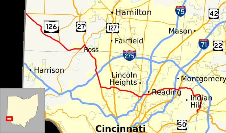
State Route 126 (SR 126) is a state route starting at the Ohio-Indiana border, at a split with State Route 129 near Scipio, Ohio, and ending east of Cincinnati at an intersection with U.S. Route 50 in Milford. State Route 126 is locally known for comprising most of Ronald Reagan Cross County Highway.
Contents
Map of Ronald Reagan Cross County Hwy, Ohio, USA
History
Prior to the completion of Ronald Reagan Cross County Highway in 1997, the central portion of State Route 126 between Ross and Montgomery consisted of West Kemper Road, Springfield Pike (State Route 4), Glendale Milford Road, Kenwood Road, and Cooper Road. On October 28, 1997, the Ohio Department of Transportation (ODOT) took over Ronald Reagan Highway, except for the segment west of Colerain Avenue. State Route 126 was rerouted over the highway, while Kemper, Glendale Milford, Kenwood, and Cooper roads were returned to local authorities.