
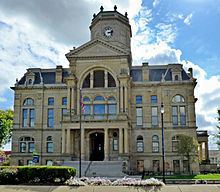
Founded May 1, 1803 Population 371,272 (2013) Unemployment rate 4.1% (Apr 2015) | Area 1,217 km² County seat Hamilton | |
 | ||
Website www.butlercountyohio.org Points of interest Hueston Woods State Park, Voice of America Bethany, William H McGuffey House, South Main Street District, Keehner Park Colleges and Universities Miami University, Butler Tech‑D Russel L, Miami University Hamilton, Miami University Voice of, Moler‑Pickens Beauty Academy | ||
Name that tune butler county ohio operation pumpkin 2014
Butler County is a county located in the U.S. state of Ohio. As of the 2010 census, the population was 368,130. Its county seat is Hamilton. It is named for General Richard Butler, who died in 1791 during St. Clair's Defeat. It is also home to Miami University, an Ohio public university.
Contents
- Name that tune butler county ohio operation pumpkin 2014
- Map of Butler County OH USA
- History
- Geography and geology
- Adjacent counties
- 2000 census
- 2010 census
- Education
- Villages
- Townships
- Paper
- Ohio House Districts
- References
Map of Butler County, OH, USA
Butler County is part of the Cincinnati, OH-KY-IN Metropolitan Statistical Area and the majority of the county rest in District 52.
History
The county was once home to seven large earthworks sites, built by ancient Indigenous peoples of the Americas that lived in the area.
Early French explorers likely passed through the area along the Miami River. The gravesites of David and Margaret Gregory indicate that they were some of the first white settlers in the area in Liberty Township. White settlers began moving into the area in larger numbers after the 1793 Treaty of Greenville was signed with the Native Americans of the area.
Butler County was formed on March 24, 1803 from portions of Hamilton County. It is named for General Richard Butler. Between 1803 and 1823, the townships of the county became officially recognized. Large portions of the county were held by non resident owners, including 640 acres owned by future President William H Harrison. Some land that was originally part of Butler County was later reassigned to Warren County in the north and Hamilton County to the south. The original size of Butler County was 480 sq miles.
The Great Flood of 1913 impacted much of the county, particularly the communities of Middletown, Ohio where approximately 25% of the town was flooded and 6 people died and Hamilton, Ohio, where 46% of the city was flooded, over 300 buildings destroyed and at least 98 people killed.
In the 1920s, Butler, Pickaway and Washington Counties were central areas of the rural membership of the Ku Klux Klan in Ohio.
In 1957 the Ohio Legislature established Hueston Woods State Park which covers 3,596 acres in Butler and neighboring Preble County, Ohio. In addition to a 625-acre man made lake, the park contains the 200 acre Hueston Woods, one of the last near-virgin growths of American beech and maple in Ohio.
Geography and geology
According to the U.S. Census Bureau, the county has a total area of 470 square miles (1,200 km2), of which 467 square miles (1,210 km2) is land and 3.1 square miles (8.0 km2) (0.7%) is water.
The majority of Butler County consists of the river valleys of the Great and Little Miami Rivers. The valley was originally carved by glaciation.
The soil at highest uplands is frequently heavy in clay, moving downhill to a sandy loam, while in the valleys the soil is black with river deposits.
Before deforestation by settlers, much of the area was forests of American beech and maple trees.
Adjacent counties
2000 census
As of the census of 2000, there were 332,807 people, 123,082 households, and 87,880 families residing in the county. The population density was 712 people per square mile (275/km²). There were 129,793 housing units at an average density of 278 per square mile (107/km²). The racial makeup of the county was 91.20% White, 5.27% Black or African American, 0.21% Native American, 1.55% Asian, 0.03% Pacific Islander, 0.62% from other races, and 1.13% from two or more races. 1.43% of the population were Hispanic or Latino of any race. 28.1% were of German, 16.7% American, 10.7% Irish and 9.8% English ancestry according to Census 2000. Those citing "American" ancestry in Butler County are of overwhelmingly English extraction, however most English Americans identify simply as having American ancestry because their roots have been in North America for so long, in some cases since the 1600s.
There were 123,082 households out of which 35.50% had children under the age of 18 living with them, 57.00% were married couples living together, 10.70% had a female householder with no husband present, and 28.60% were non-families. 22.70% of all households were made up of individuals and 7.60% had someone living alone who was 65 years of age or older. The average household size was 2.61 and the average family size was 3.07.
In the county, the population was spread out with 25.90% under the age of 18, 11.90% from 18 to 24, 29.80% from 25 to 44, 21.70% from 45 to 64, and 10.70% who were 65 years of age or older. The median age was 34 years. For every 100 females there were 95.30 males. For every 100 females age 18 and over, there were 92.20 males.
The median income for a household in the county was $47,885, and the median income for a family was $57,513. Males had a median income of $42,052 versus $27,602 for females. The per capita income for the county was $22,076. About 5.40% of families and 8.70% of the population were below the poverty line, including 9.10% of those under age 18 and 7.00% of those age 65 or over.
2010 census
As of the 2010 United States Census, there were 368,130 people, 135,960 households, and 95,404 families residing in the county. The population density was 788.2 inhabitants per square mile (304.3/km2). There were 148,273 housing units at an average density of 317.5 per square mile (122.6/km2). The racial makeup of the county was 86.0% white, 7.3% black or African American, 2.4% Asian, 0.2% American Indian, 0.1% Pacific islander, 1.8% from other races, and 2.1% from two or more races. Those of Hispanic or Latino origin made up 4.0% of the population. In terms of ancestry, 27.0% were German, 14.8% were American, 13.6% were Irish, and 9.7% were English.
Of the 135,960 households, 35.9% had children under the age of 18 living with them, 52.9% were married couples living together, 12.4% had a female householder with no husband present, 29.8% were non-families, and 23.5% of all households were made up of individuals. The average household size was 2.63 and the average family size was 3.10. The median age was 36.0 years.
The median income for a household in the county was $54,788 and the median income for a family was $68,539. Males had a median income of $50,499 versus $37,094 for females. The per capita income for the county was $25,892. About 8.3% of families and 12.8% of the population were below the poverty line, including 16.1% of those under age 18 and 6.8% of those age 65 or over.
Education
There are sixteen school districts having territory in Butler County.
Villages
Townships
There are thirteen civil townships in Butler County and at least three paper townships: