
Vehicle registration GM | Time zone CET (UTC+1) Population 280,840 (31 Dec 2010) | |
 | ||
Points of interest Hückeswagen Castle, Monkey & bird park Eckenhagen, Homburg Castle, LVR Industrial Museum, Dieringhausen Railway Museum Destinations | ||
The Oberbergischer Kreis is a Kreis (district) in the state of North Rhine-Westphalia, Germany. Neighboring districts are Ennepe-Ruhr, Märkischer Kreis, Olpe, Altenkirchen, Rhein-Sieg, Rheinisch-Bergischer Kreis, and the urban districts Remscheid and Wuppertal.
Contents
- Map of Oberbergischer Kreis Germany
- Name
- Geography
- District Administrator
- District Administrator for the management
- Economy
- Places of interest
- References
Map of Oberbergischer Kreis, Germany
Name
The area of the Bergisches Land belonged to the County of Berg for most of the medieval times, which still gives the district its name. What is called "Oberbergisch" ('upper Bergian') lies in the southeast of that earldom: Already in 1740, a description of what had meanwhile become a duchy made a distinction between the "Niederbergisch" part north of the river Wupper and the "Oberbergisch" to its south.
In 1816, after the whole Rhineland was annexed to Prussia, the districts of Waldbröl, Homburg, Gimborn, Wipperfürth, and Lennep were created on the area now covered by the district. In 1825 the districts Gimborn and Homburg were merged to the district Gummersbach. In 1932 it was merged with the district of Waldbröl, and then for the first time called Oberbergischer Kreis. The restructuring of the districts in 1969/75 did then create the district to its current extent.
Geography
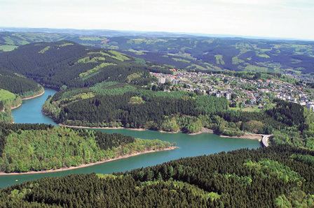
The Oberbergischer Kreis covers the hills west of the Sauerland and north of the Westerwald. It constitutes the eastern part of the Bergisches Land nature reserve. Situated at an altitude of 100–520 meters above sea level, it is rich in wood and water (numbering ten artificial lakes) and thus a recreational area for citizens from Cologne, the Ruhr area and the Netherlands.
The prevailing rock is greywacke, which was and in places still is mined in large stone quarries.
District Administrator
Since the October 1st, 1999 there is only one (directly elected) District Administrator who at the same time is head of management:
District Administrator for the management
Economy
The district's economy is marked by small and middle-sized industry, particularly in the areas of plastic and metal processing.