
Length 95 km | Source elevation 55 m | |
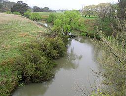 | ||
- location near Knorrit Flat, west of Wingham | ||
Nowendoc River, a perennial river of the Manning River catchment, is located in the Northern Tablelands and Mid North Coast districts of New South Wales, Australia.
Contents
Map of Nowendoc River, New South Wales, Australia
Course and features
Nowendoc River rises on the eastern slopes of the Great Dividing Range, north of the Black Sugarloaf, south of Walcha and flows generally southeast, joined by two tributaries including Cooplacurripa River and Rowleys River, before reaching its confluence with the Manning River, west of Wingham. The river descends 1,100 metres (3,600 ft) over its 115 kilometres (71 mi) course.
References
Nowendoc River Wikipedia(Text) CC BY-SA