
Source elevation 150 m | Length 75 km | |
 | ||
- location southeast of Branga Plain, south of Walcha | ||
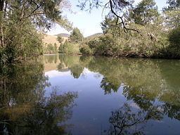
Cooplacurripa River, a perennial river of the Manning River catchment, is located in the Northern Tablelands and Mid North Coast districts of New South Wales, Australia.
Contents
Map of Cooplacurripa River, New South Wales, Australia
Course and features
Cooplacurripa River rises on the eastern slopes of the Great Dividing Range, southeast of Branga Plain, south of Walcha, and flows generally southeast by south, joined by two tributaries including the Mummel River and Walcrow River, before reaching its confluence with the Manning River, north of Gloucester. The river descends 1,120 metres (3,670 ft) over its 79 kilometres (49 mi) course.
Land adjacent to the Cooplacurripa River is principally used as grazing for beef cattle. The 22,560 hectares (55,700 acres) cattle station, Cooplacurripa, situated on the Cooplacurripa River, was formerly owned by the Australian Agricultural Company.
Cooplacurripa River falls within the Northern NSW Trout Waters and includes the whole of the waters of the river, its creeks and tributaries upstream from its junction with, and including, the Mummel River.