
Coat of arms Flag rural territorie 6 Area 13,290 km² | Rural localities 134 | |
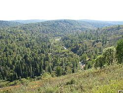 | ||
Novokuznetsky District (Russian: Новокузне́цкий райо́н) is an administrative district (raion), one of the nineteen in Kemerovo Oblast, Russia. As a municipal division, it is incorporated as Novokuznetsky Municipal District. It is located in the center of the oblast. The area of the district is 13,040 square kilometers (5,030 sq mi). Its administrative center is the city of Novokuznetsk (which is not administratively a part of the district). Population: 50,681 (2010 Census); 50,812 (2002 Census); 39,436 (1989 Census).
Contents
- Map of Novokuznetsky District Kemerovskaya Oblast Russia
- History
- Administrative and municipal status
- References
Map of Novokuznetsky District, Kemerovskaya Oblast, Russia
History
On March 19, 2007 a massive methane explosion ripped through the Ulyanovskaya mine in Novokuznetsky District killing over a hundred people. The mine was the largest coal producing center in Kemerovo Oblast. It is the deadliest mining accident in recent history.
Administrative and municipal status
Within the framework of administrative divisions, Novokuznetsky District is one of the nineteen in the oblast. The city of Novokuznetsk serves as its administrative center, despite being incorporated separately as a city under oblast jurisdiction—an administrative unit with the status equal to that of the districts.
As a municipal division, the district is incorporated as Novokuznetsky Municipal District. Novokuznetsk City Under Oblast Jurisdiction is incorporated separately from the district as Novokuznetsky Urban Okrug.