
Area 95,500 km² | Federal district Siberian Established January 26, 1943 Area rank 34th | |
 | ||
Clubs and Teams Metallurg Novokuznetsk, FC Kuzbass Kemerovo, Kuznetsk Bears, HC Shakhtyor Prokopyevsk Colleges and Universities Kemerovo State University, Kuzbass State Technical, Kemerovo State Medical A, Kemerovo Institute of Food Sci, Siberian State Industrial Points of interest Wonderland Park, Tomskaya Pisanitsa Museum, Kuznetskaya krepost', Gora Zelenaya, Krasnaya Gorka - muzey‑zapovednik | ||
Kemerovo Oblast (Russian: Ке́меровская о́бласть, Kemerovskaya oblast), also known as Kuzbass (Кузба́сс) after the Kuznetsk Basin, is a federal subject of Russia (an oblast), located in southwestern Siberia, where the West Siberian Plain meets the South Siberian mountains. The oblast, which covers an area of 95,500 square kilometers (36,900 sq mi), shares a border with Tomsk Oblast in the north, Krasnoyarsk Krai and the Republic of Khakassia in the east, the Altai Republic in the south, and with Novosibirsk Oblast and Altai Krai in the west. Kemerovo is the administrative center of the oblast, though Novokuznetsk is the largest city in the oblast, in terms of size. Kemerovo Oblast is one of Russia's most urbanized regions, with over 70% of the population living in its nine principal cities. Its ethnic composition is predominantly Russian, but Ukrainians, Tatars, and Chuvash also live in the oblast. The population recorded during the 2010 Census was 2,763,135.
Contents
- Map of Kemerovskaya Oblast Russia
- History
- Soviet period
- Geography
- Timezone
- Relief
- minerals and mining
- Hydrography
- Climate
- Economy
- Politics
- Honors
- Demographics
- Religion
- References
Map of Kemerovskaya Oblast, Russia
History
The oblast was established on January 26, 1943, but it has considerably older antecedents. Shors, Teleuts and Siberian Tatars are native peoples of the region. The oldest city in Kemerovo Oblast is Novokuznetsk, founded in 1618, soon after Cossack ataman Yermak's push into Siberia.
The territory of modern Kemerovo Oblast has been inhabited for several thousand years. In 1618, Kuznetsk fort was established in the south of the future oblast to protect the land from Russian and Mongolian Dzhungarian invaders. During the 19th century, the territory of the modern oblast was a part of Tomsk Governorate.
Soviet period
After the October Revolution Kuzbass becomes part of the West Siberian Krai, and then the Novosibirsk Oblast. Post revolutionary period was characterized by the transition to a planned economy, the creation of the Ural-Kuzbass industrial complex development of the coal, metallurgical and chemical industries Kuzbass Kemerovo Coke built, Kuznetsk Metallurgical Combine, a lot of new mines. Industrial enterprises are being built near the workers' settlements, which quickly became a city: Kiselevsk Osinniki Krasnobrodsky, Tashtagol Kaltan Mezhdurechensk and others.
During the Great Patriotic War, Kemerovo region became a major supplier of coal and metal. From Novokuznetsk steel produced over 50,000 tanks and 45,000 aircraft. In Kuzbass from the occupied areas were evacuated equipment 71 enterprises, most of which have remained in the Kuzbass.
In January 26, 1943, the Presidium of the USSR Supreme Soviet issued a decree, decided to allocate from the Novosibirsk Oblast of Kuzbass and the establishment on its territory of Kemerovo region with administrative center in the city of Kemerovo. In the new Oblast included 17.5% of the Novosibirsk region, 9 of the 12 cities of regional subordination, 17 of the 20 workers' settlements, 23 of the 75 districts. The population of the Kemerovo Oblast was 42% of the total population of the Novosibirsk Oblast.
Geography
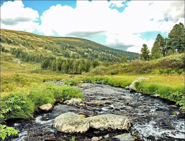
Kemerovo Region is located in the Siberian Federal District of the Russian Federation, in the south of Western Siberia, in the Tom River. The region stretches from north to south, nearly 500 km from west to east - 300 km.
Timezone
The offset from UTC is +7: 00. Concerning Moscow time the time zone has constant displacement of 4 hours and is designated in Russia as MSK + 4. September 14, 2009 the Russian Government adopted a decision on the application in the territory of the Kemerovo region since the fifth time zone - Omsk time . The transition to a new time zone in the area took place March 28, 2010, when planning for daylight saving time was implemented in Russia. As a result, the time difference between Kemerovo and Moscow reduced from four to three hours.
July 1, 2014, the State Duma adopted a decision on the application in the Kemerovo Region time six time zones - Krasnoyarsk time when planning the transition to winter time. As a result, the time difference between Kemerovo and Moscow again increased from three to four hours
Relief
Kemerovo Region is located in the south-east of Western Siberia, occupying spurs of the Altai and Sayan. Most of the difference in height the surface determines the diversity of natural conditions. The highest point of - char upper tooth on the border with the Republic of Khakassia, rises to 2178 m, the lowest - 78 meters above sea level lies in the Tom river valley on the border with the Tomsk region. According to the relief area area is divided into plain (northern part), foothill and mountain areas (Kuznetsky Alatau (in the east), Salairsky logs (in the west), Mountain Shoria (South)), intermountain Kuznetsk Basin
minerals and mining
In the depths of the field found a variety of minerals: coal, iron and polymetallic ores,gold , phosphate rock, building stone and other mineral resources. By the combination of the presence of natural resources and the region can be called unique.
Hydrography
The river network belongs to the basin of the Ob River and is characterized by significant density. The largest rivers - Tom, Yin, Kiya, Condom, Mrassu, Sarah-Chumysh, Chumysh, Yaya. Lakes in the area a bit, they are located mainly in the mountains and river valleys. The most unique in the nature of a lake Berchikul.
Climate
The climate of the oblast is continental: winters are cold and long, summers are warm, but short. The average January temperature ranges from −17 to −20 °C (1 to −4 °F), the average in July is 17 to 18 °C (63 to 64 °F). Average annual precipitation ranges from 300 millimeters (12 in) on the plains and the foothills of up to 1,000 millimeters (39 in) or more in mountainous areas. The duration of the frost-free period is 100 days in the north area, and up to 120 days in the south of the Kuznetsk Basin.
Economy
Kemerovo Oblast is one of Russia's most important industrial regions, with some of the world's largest deposits of coal. The south of the region is dominated by metallurgy and the mining industry, as well as mechanical engineering and chemical production. The Evraz Group and an ore subsidiary Evrazruda operate iron ore mining and processing facilities along with the Raspadskaya, Yuzhkuzbassugol, the Siberian holding company SIBPLAZ, coal and coking coal mines there. The northern area of the region is more agricultural. The region has a dense railway network, including the Trans-Siberian Railway, which passes through the oblast. Prokopevsk, Kiselevsk, and Andzhero-Sudzhensk are coal-producing centers, and Novokuznetsk is the center of the engineering industry.
Politics
During the Soviet period, the high authority in the oblast was shared between three persons: The first secretary of the Kemerovo CPSU Committee (who in reality had the biggest authority), the chairman of the oblast Soviet (legislative power), and the Chairman of the oblast Executive Committee (executive power). Since 1991, CPSU lost all the power, and the head of the Oblast administration, and eventually the governor was appointed/elected alongside elected regional parliament.
The Charter of Kemerovo Oblast is the fundamental law of the region. The Legislative Assembly of Kemerovo Oblast is the province's standing legislative (representative) body. The Legislative Assembly exercises its authority by passing laws, resolutions, and other legal acts and by supervising the implementation and observance of the laws and other legal acts passed by it. The highest executive body is the Oblast Government, which includes territorial executive bodies such as district administrations, committees, and commissions that facilitate development and run the day to day matters of the province. The Oblast administration supports the activities of the Governor who is the highest official and acts as guarantor of the observance of the oblast Charter in accordance with the Constitution of Russia.
Honors
A minor planet 2140 Kemerovo discovered in 1970 by Soviet astronomer Tamara Mikhailovna Smirnova is named after Kemerovo Oblast.
Demographics
Population: 2,763,135 (2010 Census); 2,899,142 (2002 Census); 3,176,335 (1989 Census).
2009 - 1.67 | 2010 - 1.62 | 2011 - 1.59 | 2012 - 1.76 | 2013 - 1.79 | 2014 - 1.78 | 2015 - 1.73 | 2016 - 1.72(e)
Ethnic composition (2010):
Religion
As of a 2012 official survey 34.1% of the population of Kemerovo Oblast adheres to the Russian Orthodox Church, 7% declares to be nondenominational Christian (excluding the Protestant churches), 3% are members of Rodnovery, the Slavic folk religion, 1% are either believers of Orthodox Christianity not belonging to any church or members of other (non-Russian) Orthodox churches, 1% are Muslims, 5.9% are followers of other religion or people who did not give an answer to the survey. In addition, 31% of the population declares to be "spiritual but not religious" and 17% to be atheist.