
Sovereign state United Kingdom Founded 1974 Area 284.4 km² | Constituent country England | |
 | ||
Points of interest Destinations | ||
North Warwickshire is a local government district and borough in Warwickshire, England. The main town in the district is Atherstone where the offices of North Warwickshire Borough Council are based. Other significant places include Coleshill, Polesworth and Kingsbury.
Contents
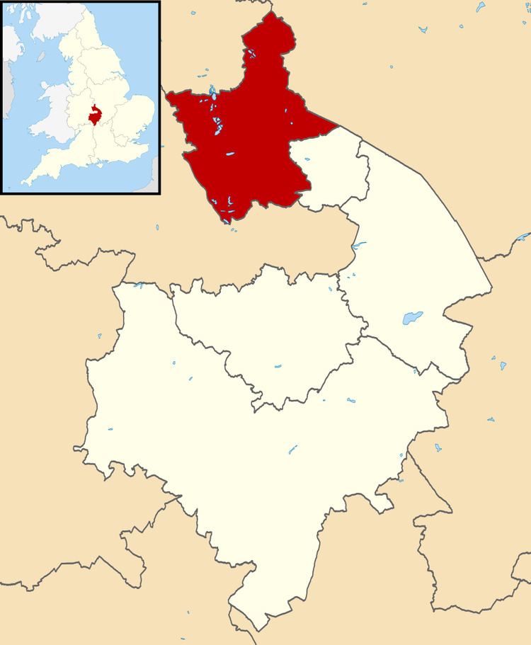
- Map of North Warwickshire District UK
- Parishes and settlements
- Local election results 1973 2011
- Parties
- References
Map of North Warwickshire District, UK
The North Warwickshire district was created on 1 April 1974 by a merger of the Atherstone Rural District and parts of the Meriden Rural District (the rest of which was merged into the West Midlands county).
North Warwickshire is a mostly rural area with several small towns. The area historically had a large coal mining industry, but this has almost died out. The district is relatively remote from the rest of Warwickshire, as the county is almost split in two by the West Midlands.
The boundaries of North Warwickshire are similar to those of the North Warwickshire parliamentary constituency. However the constituency also includes the town of Bedworth. The local MP is Craig Tracey.
In 2007 the Conservatives took overall control of the Borough Council for the first time since the creation of the council within its current boundaries. The Council was retaken by Labour in 2011.
It borders the Warwickshire district of Nuneaton and Bedworth to the east, the county of Leicestershire to the north-east, Staffordshire to the north-west, and the West Midlands to the south and south-west.
Parishes and settlements
Settlements in North Warwickshire include:
For a list of wards in North Warwickshire by population see here
Local election results 1973-2011
As of May 2015, the party composition was as follows:
Historically, local election results have fallen like this:
Parties
The Borough is a very marginal seat between the Conservatives and Labour. Within the Borough, Polesworth East, Dordon, and Wood End are considered Labour safe seats, and Fillongley, Water Orton, Newton Regis and Curdworth are considered safe Conservative seats.