
City Portland Number of households 2,227 | State Oregon Area 150 ha | |
 | ||
Restaurants Tabor Tavern, Big‑Ass Sandwich, UFO Pizza, Laurelhurst Cafe, A & L Sports Pub | ||
North Tabor Neighborhood in Portland, Oregon, United States, is on the east side of the Willamette River on the northern slope of Mount Tabor. The Banfield Expressway (Interstate 84) forms its northern boundary, separating it from the Hollywood District, Rose City Park, and Madison South neighborhoods to the north. NE/SE 44th Ave. separates it from Laurelhurst to the west and NE 68th Ave. from Montavilla to the east. East Burnside Street forms most of the southern boundary (separating it from the Mount Tabor Neighborhood), except for a section west of SE 49th Ave. for which SE Stark St. forms the boundary with the Sunnyside neighborhood.
Map of North Tabor, Portland, OR, USA
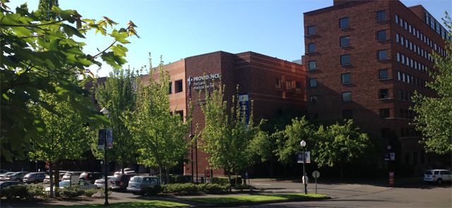
Providence Portland Medical Center is the neighborhood's largest employer. Other businesses include Glisan Fred Meyer, Biddy McGraws, Seven Virtues coffeehouse, Tabor Tavern, Los Taquitos, The Hutch, American Dream Pizza, and the Laurelhurst Cafe.
The NE 60th Ave station on the Blue Line, Red Line and Green Line of the MAX light rail system is on the boundary with the Rose City Park neighborhood. Buses serve the neighborhood on NE Glisan, East Burnside and 60th Avenue. A marked bike route travels east-west on NE Davis/Everett streets and the planned 50s bike boulevard extends through North Tabor.