
Existed: 1970s – present | Length 14.77 km | |
 | ||
Counties | ||
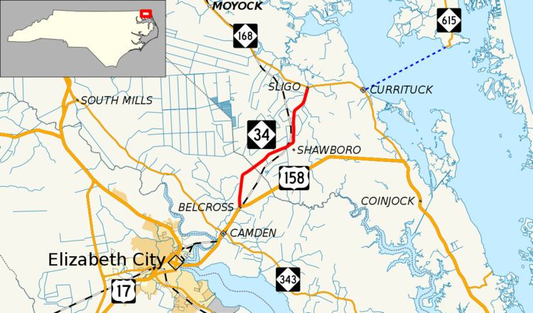
North Carolina Highway 34 (NC 34) is a short north–south state highway in the U.S. state of North Carolina. Spanning a distance of 9.177 miles (14.769 km), the route passes through a few small unincorporated communities in eastern North Carolina's Inner Banks near Elizabeth City.
Contents
Map of NC-34, North Carolina, USA
Route description
The route's southern terminus is the intersection with U.S. Route 158 (US 158) in the community of Belcross, in Camden County. From there, it progresses in a general northeastern direction through Hastings Corners, where it also becomes known as Shawboro Road. After uniting with Indiantown Road, NC 34 continues north to its northern terminus at NC 168 in Sligo, Currituck County.
History
Over the years since the 1930s, NC 34 has occupied a variety of routes in the northeastern part of North Carolina, including current-day NC 168, NC 343, NC 344, and US 158.