
Existed: 1961 – present Length 14.6 km | Constructed 1961 | |
 | ||
County | ||
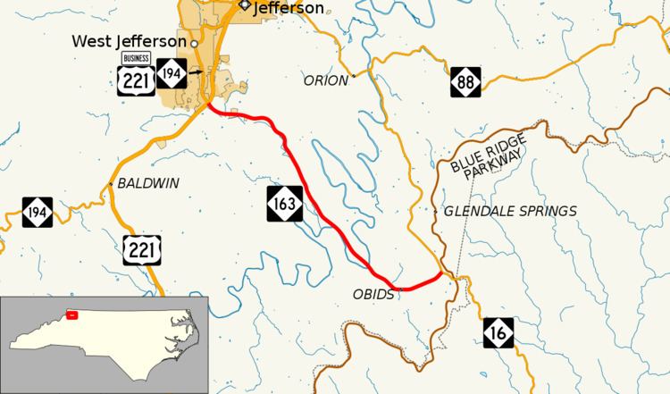
North Carolina Highway 163 (NC 163) is a primary state highway in the U.S. state of North Carolina. The highway serves as a direct route from West Jefferson towards Wilkesboro.
Contents
Map of NC-163, West Jefferson, NC 28694, USA
Route description
NC 163 is a two-lane mountain highway that traverses 9.1 miles (14.6 km) from West Jefferson to NC 16. The highway travels with gliding curves through the valley area, with nearby mountains including Mount Jefferson, Round Knob and Frenches Knob along its edges. A majority of the route parallels Beaver Creek down to its confluence with the South Fork New River. At its eastern terminus, travelers can continue south on NC 16 to the Blue Ridge Parkway, located at Horse Gap (3,128 feet (953 m)), or continue down the mountain towards Wilkesboro.
History
Established in 1961 as a new primary routing along an existing secondary road (SR 1002), from West Jefferson to near Horse Gap; little has changed since.
Junction list
The entire route is in Ashe County.