
- elevation 138 m (453 ft) - elevation 0 m (0 ft) - elevation 140 m (459 ft) Area 101.5 km² | - elevation 1,103 m (3,619 ft) - location Praça da República Local time Wednesday 9:25 AM | |
 | ||
Weather 14°C, Wind SW at 32 km/h, 78% Humidity | ||
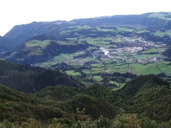
Nordeste ([ˌnɔɾˈðɛʃt(ɨ)]; Portuguese for northeast, hence that part of the island) is a municipality on the northeastern part of São Miguel Island in the Azores. The population in 2011 was 4,937, in an area of 101.47 square kilometres (39.18 sq mi).
Contents
Map of Nordeste, Portugal
Geography
The municipality Nordeste covers the northeastern part of the island São Miguel. It is the least populated on the island of São Miguel, and most of its interior is covered forests, mountainous peaks and river-valleys, punctuated by fertile pastureland. The highest elevations in this region include Pico Redondo (980 metres), Pico Verde (927 metres), Pico Bartolomeu (887 metres) and Pico da Vara (1103 metres), the highest point on the island of São Miguel.
Administratively, there are nine civil parishes in the municipality:
The parish Nordeste has a population of 1,341 (2011) and an area of 23.13 square kilometres (8.93 sq mi).
Sports
The following sports clubs are located in Nordeste: