
Country Canada Founded 1909 Elevation 985 m Local time Tuesday 2:41 PM | Time zone MST (UTC-7) Population 1,278 (2016) Province Alberta | |
 | ||
Weather 12°C, Wind SW at 32 km/h, 30% Humidity | ||
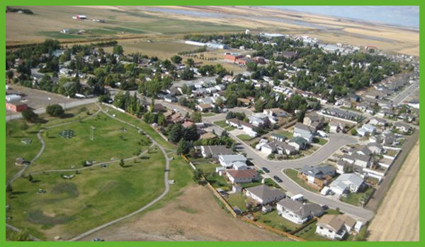
Drone over nobleford alberta
Nobleford is a village in southern Alberta, Canada and serves primarily as bedroom community of Lethbridge. It is located 32 km (19 mi) north of the city of Lethbridge.
Contents
- Drone over nobleford alberta
- Map of Nobleford AB Canada
- Nobleford noble central school 2014
- History
- Government
- Demographics
- Transportation
- Education
- Amenities
- References
Map of Nobleford, AB, Canada
Nobleford noble central school 2014
History
The hamlet of Noble was established in 1909. It was named after Charles S. Noble, who owned much land in the area and built many of the local buildings. In 1910, Noble moved his family to the area from Claresholm. The hamlet was renamed Nobleford in 1913, in order to differentiate from a town in Ontario.
In 1918, Nobleford was incorporated as a village with a population of 100, and its first mayor was Noble.
A major employer in Nobleford from the 1930s to 1998 was a cultivator factory established by Charles Noble, manufacturing variations of the Noble blade. This reduced-tillage plow was designed to cut weed roots below the soil surface without greatly disturbing the soil, thus minimizing moisture loss in the dry, windy climate of southern Alberta.
Government
The village is governed by a council composed of a mayor, a deputy mayor, and three councillors.
Demographics
In the 2016 Census of Population conducted by Statistics Canada, the Village of Nobleford recorded a population of 1,278 living in 404 of its 427 total private dwellings, a 7001278000000000000♠27.8% change from its 2011 population of 1,000. With a land area of 1.59 km2 (0.61 sq mi), it had a population density of 803.8/km2 (2,081.8/sq mi) in 2016.
In the 2011 Census, the Village of Nobleford had a population of 1,000 living in 334 of its 375 total dwellings, a 45.1% change from its 2006 population of 689. With a land area of 1.54 km2 (0.59 sq mi), it had a population density of 649.4/km2 (1,681.8/sq mi) in 2011. At its current population, Nobleford is one of the largest villages in the province and is eligible for town status. According to Alberta's Municipal Government Act, a village is eligible for town status when it reaches 1,000 residents.
The population of the Village of Nobleford according to its 2009 municipal census is 877.
In 2006, Nobleford had a population of 689 living in 228 dwellings, a 13.0% increase from 2001. The village has a land area of 1.17 km2 (0.45 sq mi) and a population density of 589.9/km2 (1,528/sq mi).
Transportation
Nobleford is located on Highway 519, just east of Highway 23. It is also serviced by rail and Greyhound bus service.
Education
The village is served by Nobleford Central School, a K-12 public school that opened in 1949. It employs 15 teachers and several educational assistants, and provides education to many of the children in the village and the surrounding rural area.
Amenities
The Community Complex is one of the more popular recreational facilities in Nobleford. It houses a curling rink, a large meeting room and an auditorium; it is used for such events as dances weddings and various sports.
In addition, Nobleford is home to three baseball diamonds, two soccer fields, a climbing wall, a tennis court, a skating rink, a skate park and a picnic shelter and barbecue.
Nearby Keho Lake is a popular recreational destination, most well known among windsurfers and kiteboarders, and an important agricultural water reservoir. Anglers also frequent the lake, in which northern pike, walleye, and burbot can be found. Adjacent to the lake is a nine-hole golf course.