
Population 62 (2001) Sovereign state United Kingdom Local time Sunday 1:11 PM UK parliament constituency Wellingborough | OS grid reference SP9965 Dialling code 01933 | |
 | ||
Weather 13°C, Wind E at 24 km/h, 61% Humidity | ||
Newton Bromswold is a village and civil parish about 1.9 miles (3.1 km) east of Rushden in Northamptonshire, England, adjacent to the border with Bedfordshire. At the 2001 census the parish's population was 62 people in 27 households. The population remained less than 100 at the 2011 Census and is included in the town of Rushden. It is near the villages of Wymington, Chelveston, Knotting, Knotting Green, Yielden and Melchbourne. There is a pub and a small church. The village takes its name from the forest which once stood where the village is today, called Bruneswald Forest.
Contents
Map of Newton Bromswold, UK
The Swan public house
The village pub features in one of local author H.E. Bates's novels, and was frequented by US bomber pilots from nearby RAF Chelveston in the war. it has its own car park, a garden and a games room.
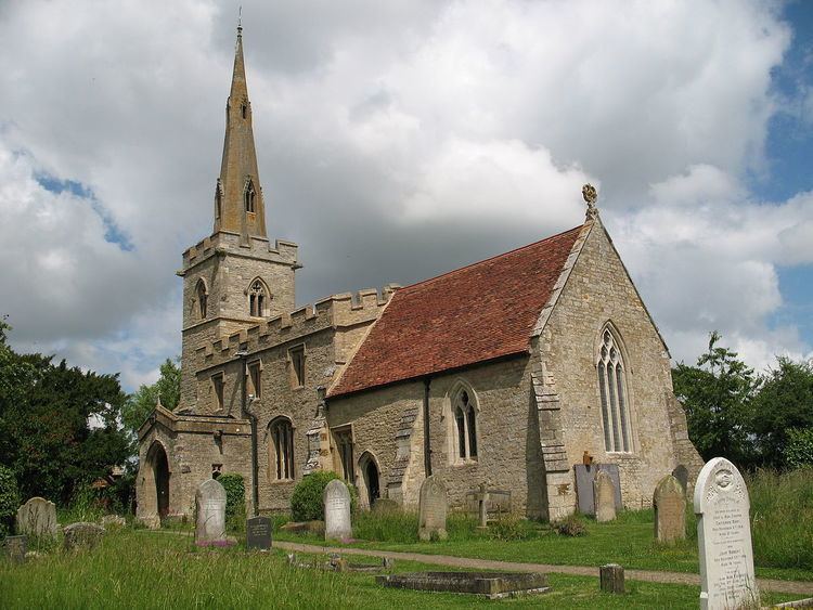
St. Peter's Church
The village's church, named for Saint Peter, is known for its exquisite medieval stained glass. The church has three bells, one of which is unmarked and it is thought to be over 500 years old.