
 | ||
Route 460 is a Canadian provincial highway in Newfoundland and Labrador.
Contents
- Map of NL 460 Newfoundland and Labrador Canada
- Construction history for Hansen Memorial Highway section
- References
Map of NL-460, Newfoundland and Labrador, Canada
It is located on the west coast of the island of Newfoundland and has its western terminus at Cape St. George, the westernmost tip of the Port au Port Peninsula, and its eastern terminus at an interchange in Harrys Brook with Highway 1, the Trans-Canada Highway.
The highway has developed in several distinct sections:
Construction history for Hansen Memorial Highway section
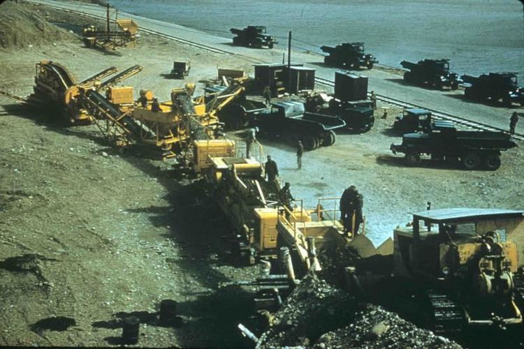
The US Army Corps of Engineers began work on the Stephenville bypass road in the 1950s. Company C, under the command of Capt. Claxton Ray, began at Stephenville and worked towards Company B, under the command of Capt. Gomez, which had commenced construction near Cormiers Village and were working in both directions, towards Long Gull Pond and towards Stephenville. It was necessary for Company B to begin construction of the road at Cormiers Village and work back towards Stephenville pending the finalizing of property agreements.
The eleven mile (18 km) long highway construction project began with a line of corduroy roads comprising one half of the road, and when Long Gull Pond was reached in the fall of 1954, the other half was constructed. The road was then extended along the Newfoundland Railway main line from Long Gull Pond to Stephenville Crossing (this section is now the eastern terminus of Route 461.
It was necessary to build three access roads approximately two miles in length in order to facilitate construction of the bypass road. These roads were built to the same specifications as the bypass road as they were used constantly for heavy hauling. A concrete bridge was built over Cold Creek in 1954 and a 60 foot (20 m) concrete bridge was built over Warm Creek in 1956.
The project required 90,000 cubic yards (70,000 m³) of fill as well as 30,000 cubic yards (20,000 m³) of crushed rock to complete the sub-base. The travel surface required 15,000 cubic yards (10,000 m³) of gravel, 19 inches thick before asphalt was applied. Construction equipment and material were stored at a depot Long Gull Pond during the project.
The bypass road was officially opened for military and public users in October 1957.