
Country United States Incorporated 1853 Elevation 326 m Population 973 (2013) | Settled 1840 Time zone Eastern (EST) (UTC-5) Zip code 16242 Local time Saturday 1:27 AM | |
 | ||
Weather 15°C, Wind SW at 10 km/h, 72% Humidity Area 135 ha (122 ha Land / 13 ha Water) | ||
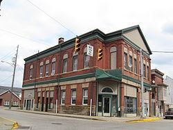
New Bethlehem is a borough in Clarion County, Pennsylvania, United States. The population was 989 at the 2010 census.
Contents
- Map of New Bethlehem PA 16242 USA
- Geography
- History
- Demographics
- Peanut Butter Festival
- Flood of 1996
- Education
- References
Map of New Bethlehem, PA 16242, USA
Geography
New Bethlehem is located along the southern border of Clarion County at 41°0′12″N 79°19′51″W (41.003302, -79.330935). It is in the valley of Redbank Creek, which separates the borough from South Bethlehem, Armstrong County to the south.
Pennsylvania Route 28 passes through the borough, crossing Redbank Creek into South Bethlehem, then leading southwest 20 miles (32 km) to Kittanning on the Allegheny River. To the northeast, PA 28 leads 20 miles (32 km) to Brookville and Interstate 80. Pennsylvania Route 66 intersects PA 28 in the center of New Bethlehem and leads north 13 miles (21 km) to I-80 and 16 miles (26 km) to Clarion, the county seat. PA 66 travels with PA 28 southwest to Kittanning. Pennsylvania Route 861 leads west from New Bethlehem 12 miles (19 km) to Rimersburg.
According to the United States Census Bureau, the borough of New Bethlehem has a total area of 0.50 square miles (1.3 km2), of which 0.46 square miles (1.2 km2) is land and 0.04 square miles (0.1 km2), or 9.92%, is water.
History
One of the prominent early settlers of the borough was Henry "Gum" Nolf (alternative spellings include Nulph), who built the first store, grist-, and saw-mill. The town was first referred to as "Gumtown" in honor of Nolf, but subsequently was named "Bethlehem", and later "New Bethlehem" to distinguish it from Bethlehem, Pennsylvania, in the eastern part of the state.
Demographics
As of the census of 2000, there were 1,057 people, 489 households, and 274 families residing in the borough. The population density was 2,217.9 people per square mile (850.2/km²). There were 575 housing units at an average density of 1,206.5 per square mile (462.5/km²). The racial makeup of the borough was 98.49% White, 0.76% African American, 0.09% Native American, 0.09% Asian, 0.09% from other races, and 0.47% from two or more races. Hispanic or Latino of any race were 0.57% of the population.
There were 489 households, out of which 21.9% had children under the age of 18 living with them, 44.0% were married couples living together, 9.4% had a female householder with no husband present, and 43.8% were non-families. 40.1% of all households were made up of individuals, and 22.3% had someone living alone who was 65 years of age or older. The average household size was 2.08 and the average family size was 2.80.
In the borough the population was spread out, with 19.0% under the age of 18, 6.8% from 18 to 24, 24.2% from 25 to 44, 23.8% from 45 to 64, and 26.1% who were 65 years of age or older. The median age was 45 years. For every 100 females there were 81.0 males. For every 100 females age 18 and over, there were 75.4 males.
The median income for a household in the borough was $25,069, and the median income for a family was $38,750. Males had a median income of $30,750 versus $20,469 for females. The per capita income for the borough was $17,796. About 13.9% of families and 16.0% of the population were below the poverty line, including 20.0% of those under age 18 and 9.4% of those age 65 or over.
Peanut Butter Festival
The city is home to a relatively unknown Peanut Butter Festival. Though the town is home to the Smucker's factory, the company does not sponsor the festival. The Peanut Butter Festival is a Redbank Valley Chamber of Commerce-sponsored event and is mainly set in the Gumtown Park.
Flood of 1996
On July 19, 1996, a flood hit New Bethlehem as well as other parts of Pennsylvania. Reports state that the Redbank Creek was over seven feet above flood stage, and much of the downtown area was underwater. Redbank Valley High School was shut down. It took a few months to clean and fix the damage until students were allowed to attend again. On a garage east of the Redbank Valley High School there is a line that shows how high the water level was at its highest point.
Education
New Bethlehem is home to the Redbank Valley School District and two of the districts school buildings, it's baseball fields and football and soccer fields