
Existed: 1928 – present Length 18.78 km | Constructed 1928 | |
 | ||
County | ||
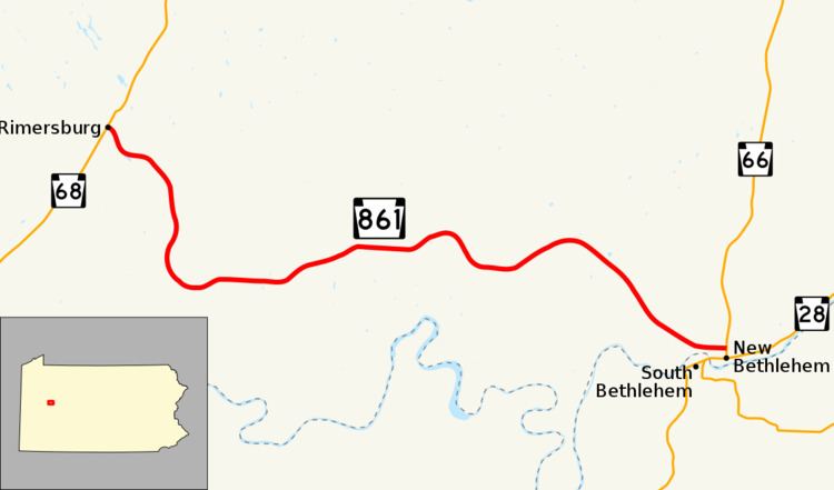
Pennsylvania Route 861 (PA 861) is a 11.67-mile-long (18.78 km) state highway located in Clarion county in Pennsylvania. The western terminus is at PA 68 in Rimersburg. The eastern terminus is at PA 66 in New Bethlehem.
Contents
Map of PA-861, Pennsylvania, USA
Route description
PA 861 begins at an intersection with PA 68 in Rimersburg, heading southeast on a two-lane undivided road. The route heads into Toby Township and runs through forests, soon crossing into Madison Township. The road curves south, passing through Diamond before making a turn to the east and continuing into agricultural areas. PA 861 enters Porter Township and continues east through a mix of farmland and woodland with occasional homes. The route heads to the southeast through more rural areas before curving east and heading into New Bethlehem. At this point, the PA 861 becomes Penn Street and passes homes, ending at an intersection with PA 66.
Major intersections
The entire route is in Clarion County.