
Existed: 1948 – present Length 26.03 km | Constructed 1948 | |
 | ||
Counties | ||
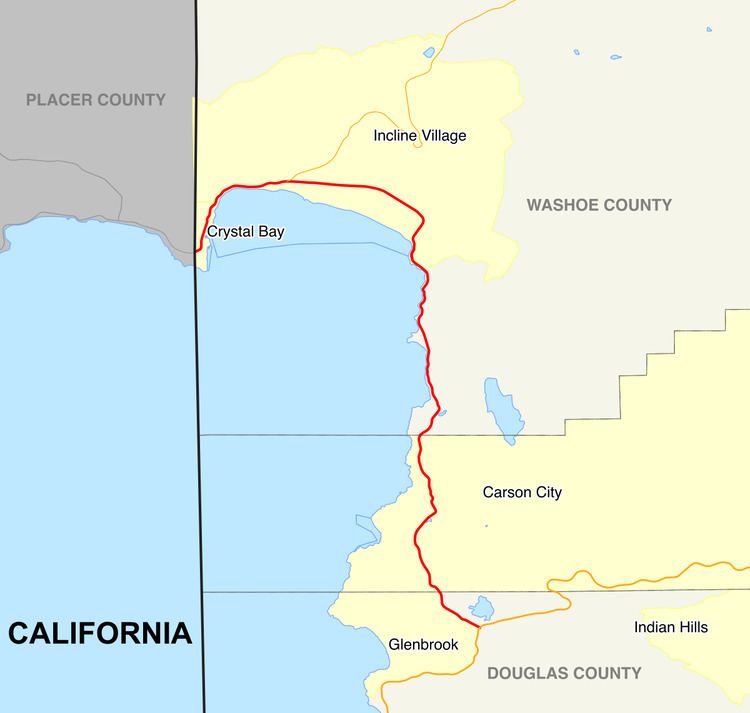
State Route 28 (SR 28) is a 16.2-mile (26.1 km) road that runs along the northeastern shore of Lake Tahoe. SR 28 starts at US 50 and ends at the California state line at Crystal Bay, continuing across the border as SR 28. SR 28 is part of the National Scenic Byway system since September 1996, and the state scenic byway system since June 1994.
Contents
Map of NV-28, Nevada, USA
The highway serves Douglas County and Washoe County as well as a rural part of Carson City. SR 28 was designated in 1948, and has not significantly changed since it was first paved.
Route description
SR 28 begins at U.S. Route 50 (US 50) in Douglas County, Nevada. It heads north from there, forming part of the boundary of Lake Tahoe – Nevada State Park until crossing into Carson City. The highway then enters Washoe County, where the highway enters Humboldt-Toiyabe National Forest. It then turns northwest, running through Incline Village. In western Incline Village, SR 28 junctions with SR 431, which is a direct link to Reno to the northeast. Just short of the California state line, it turns south to run parallel to the line and finally crosses into California at Crystal Bay. The road continues west of the California border as California State Route 28.
The route has been designated as the north piece of the Lake Tahoe–Eastshore Drive Scenic Byway, as part of the National Scenic Byway program. SR 28 was also designated as a state scenic byway. SR 28 is not part of the National Highway System. Around 11,300 cars use SR 28 on average each day.
History
The road that became SR 28 was paved around 1932, and has been used for flumes in the timber industry since 1880. The route first appeared in 1948, with the same general alignment as it has today. The highway gained fame for many years as the location of the Ponderosa Ranch, filming location of the television series Bonanza. On June 7, 1994, the Nevada Department of Transportation (NDOT) designated SR 28 as a scenic byway, named North Shore Road. Later in September 1996, SR 28 and part of US 50 was designated as Lake Tahoe - Eastshore Drive, a National Scenic Byway.