
Existed: 1976 – present Length 23.38 km | Constructed 1976 | |
 | ||
South end: 5 miles south of Steeles Creek | ||
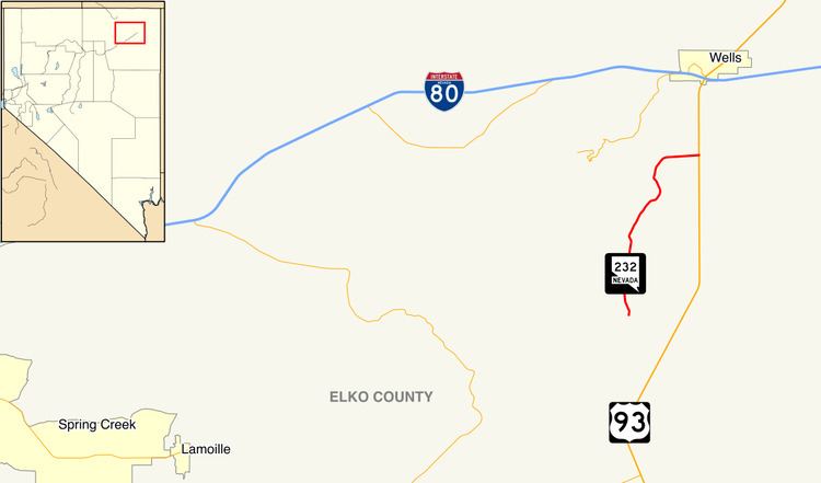
State Route 232 (SR 232) is a state highway in Elko County, Nevada. It covers the majority of Clover Valley Road south of Wells.
Contents
Map of NV-232, Wells, NV 89835, USA
Route description
State Route 232 begins in the Clover Valley on Clover Valley Road about five miles (8.0 km) south of Steeles Creek, at the north end of Elko County Route 782. From there, the route travels northward through the desert valley, somewhat paralleling U.S. Route 93 (US 93) to the east, as it traverses near the base of the East Humboldt Range. SR 232 serves a number of ranches and crosses several creeks as it treks northward through Clover Valley. After rounding the east side of Signal Hill, the highway turns eastward. The route comes to an end at a junction with US 93 about 5.5 miles (8.9 km) south of Wells.
History
SR 232 was designated on July 1, 1976.
Major intersections
The entire route is in Elko County.