
Website elkocountynv.net Founded 1869 | Largest city Elko Area 44,556 km² Population 52,384 (2013) University Great Basin College | |
 | ||
Points of interest Peppermill Wendover, Montego Bay Resort, Rainbow Casino, Wendover Nugget, Red Garter Casino | ||
Elko County is a county located in the northeastern corner of the U.S. state of Nevada. As of the 2010 census, the population was 48,818. Its county seat is Elko. The county was established on March 5, 1869, from Lander County.
Contents
- Map of Elko County NV USA
- History
- Geography
- National protected areas
- Time zones
- 2000 census
- 2010 census
- Government and politics
- Transportation
- References
Map of Elko County, NV, USA
Elko County is the fourth-largest county by area in the contiguous United States, ranking lower when the boroughs of Alaska are included. It is one of only 10 counties in the U.S. with more than 10,000 square miles (25,900 km2) of area.
Elko County is part of the Elko, NV Micropolitan Statistical Area. It contains 49.8 percent of the Duck Valley Indian Reservation, set up in the late 19th century for the Shoshone-Paiute peoples; they are a federally recognized tribe. Although slightly more than 50% of the reservation is located across the border in Owyhee County, Idaho, the majority of tribal members live on the Nevada side. The total land area of the reservation is 450.391 square miles (1,166.5 km2).
History
This area was long occupied by Native American tribes of the Plateau, particularly the Western Shoshone, Northern Paiute, and Bannock peoples. Their traditional ways were disrupted after European-American settlement, as the two cultures competed for resources and had differing conceptions of land use and property.
Elko County was established by European Americans in 1869 from Lander County; the name was taken from the name of the county seat, Elko.
In 1877 what became known as the Duck Valley Indian Reservation was established by presidential executive order for the Western Shoshone in this area, after they signed treaties with the United States. Later the Paiute became involved in the Bannock War, but after they were allowed to return from exile in Washington State, in 1886 another executive order was used to expand the reservation to accommodate them. The federally recognized tribe of the two peoples together conducts farming and ranching in this high desert territory.
The population of the county increased markedly in the late 20th century as the economy improved.
On March 14, 2014, the Bureau of Land Management sold 29 oil and gas leases for $1.27 million to a collection of six companies that included Noble Energy. The transaction was the first such in Nevada.
Geography
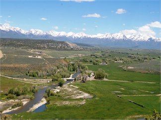
According to the U.S. Census Bureau, the county has a total area of 17,203 square miles (44,560 km2), of which 17,170 square miles (44,500 km2) is land and 33 square miles (85 km2) (0.2%) is water. Not counting Alaska's boroughs (four of which are also larger), it is the fourth-largest county in area in the United States (behind San Bernardino County, California, Coconino County, Arizona, and Nye County, Nevada). The elevation ranges from about 4,300 feet (1,300 m) at the edge of the salt flats of the Great Salt Lake Desert, to 11,387 feet (3,471 m) on the summit of Ruby Dome in the Ruby Mountains. The most topographically prominent mountain in Elko County is Pilot Peak.
The county has three physiographic sections (70% Great Basin section, 20% Payette, 10% Snake River Plain) and 4 watersheds (45% Humboldt River, 30% Upper Snake River, 20% central Nevada desert, 5% Pilot-Thousand Springs).
National protected areas
Time zones
Except for West Wendover which is in the Mountain Time Zone, the county is in the Pacific Time Zone, though other communities such as Owyhee, Mountain City, Jarbidge and Jackpot unofficially observe Mountain Time as well due to their proximity to, and economic connections with, neighboring areas of Idaho.
2000 census
As of the census of 2000, there were 45,291 people, 15,638 households, and 11,493 families residing in the county. The population density was 3/sq mi (1/km²). There were 18,456 housing units at an average density of 1/sq mi (0/km²). The racial makeup of the county was 82.04% White, 0.59% Black or African American, 5.30% Native American, 0.68% Asian, 0.11% Pacific Islander, 8.50% from other races, and 2.78% from two or more races. 19.73% of the population were Hispanic or Latino of any race.
There were 15,638 households out of which 43.00% had children under the age of 18 living with them, 59.30% were married couples living together, 8.40% had a female householder with no husband present, and 26.50% were non-families. 20.90% of all households were made up of individuals and 4.80% had someone living alone who was 65 years of age or older. The average household size was 2.85 and the average family size was 3.33.
In the county, the population was spread out with 32.50% under the age of 18, 8.80% from 18 to 24, 31.50% from 25 to 44, 21.30% from 45 to 64, and 5.90% who were 65 years of age or older. The median age was 31 years. For every 100 females there were 108.80 males. For every 100 females age 18 and over, there were 109.40 males.
The median income for a household in the county was $48,383, and the median income for a family was $52,206. Males had a median income of $41,322 versus $24,653 for females. The per capita income for the county was $18,482. About 7.00% of families and 8.90% of the population were below the poverty line, including 9.50% of those under age 18 and 7.60% of those age 65 or over.
2010 census
As of the 2010 United States Census, there were 48,818 people, 17,442 households, and 12,441 families residing in the county. The population density was 2.8 inhabitants per square mile (1.1/km2). There were 19,566 housing units at an average density of 1.1 per square mile (0.42/km2). The racial makeup of the county was 79.4% white, 5.3% Native American, 0.9% Asian, 0.8% black or African American, 0.1% Pacific islander, 10.3% from other races, and 3.2% from two or more races. Those of Hispanic or Latino origin made up 22.9% of the population. In terms of ancestry,
Of the 17,442 households, 39.8% had children under the age of 18 living with them, 55.7% were married couples living together, 9.1% had a female householder with no husband present, 28.7% were non-families, and 22.5% of all households were made up of individuals. The average household size was 2.77 and the average family size was 3.26. The median age was 33.4 years.
The median income for a household in the county was $67,038 and the median income for a family was $75,171. Males had a median income of $56,528 versus $34,464 for females. The per capita income for the county was $26,879. About 5.8% of families and 7.1% of the population were below the poverty line, including 8.0% of those under age 18 and 9.0% of those age 65 or over.
Government and politics
Elko is a highly conservative area. In 2011, all eleven of the partisan county officials were Republican. In the 2004 Presidential Election, George W. Bush won 78% of the county's vote, while 20% voted for John F. Kerry. In 2008 voters in Elko County chose John McCain by 69%, with 28% voting for Barack Obama.
Both former President Jimmy Carter and then-President George W. Bush made visits to the city of Elko during the 2006 mid-term election. William McKinley visited in 1901; Herbert Hoover made his final campaign broadcast as president from a railroad car in Elko in 1932; Franklin D. Roosevelt spoke in Carlin in 1938 during his whistle stop tour; and Barack Obama visited while campaigning in 2008. In addition, many other high-profile political figures have come to Elko, including former Vice President Dick Cheney. In 2016 Donald Trump Jr. campaigned in Elko during the primary campaign.
Transportation
A number of highways maintained by the Nevada Department of Transportation, some national in prominence, cross Elko County (see Major highways above). The county also maintains a network of county routes; however, many of them are unpaved and receive limited, if any, winter maintenance.
Transportation by means other than road vehicle is limited within Elko County. Commercial air service is available only at the Elko Regional Airport in Elko; the only destination currently served is Salt Lake City International Airport. Other public airports in Elko County include Jackpot Airport, Owyhee Airport and Wells Municipal Airport.
Amtrak passenger service is available from the unstaffed Elko station. Service is via the California Zephyr and is either eastbound or westbound, once a day.