
Elevation 410 m | Area 25.48 km² | |
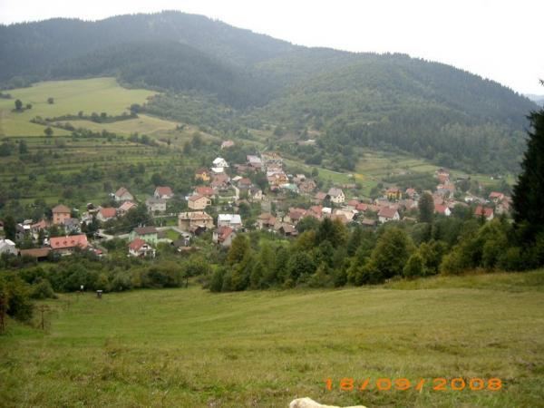 | ||
Nesluša is a village and municipality in the Kysucké Nové Mesto District in the Zilina Region of northern Slovakia.
Contents
- Map of 023 41 NesluC5A1a Slovakia
- History
- Historical variants of the name
- Geography
- iarinka
- Demography
- Historical demography
- Parts of the village
- Parts of village in highland
- Hockeyball
- Accommodation
- Politics
- References
Map of 023 41 Neslu%C5%A1a, Slovakia
History
In historical records the village was first mentioned in 1367.
Historical variants of the name
Geography
The municipality lies at an elevation of 439 metres (1,440 ft) and covers an area of 25.472 square kilometres (9.835 sq mi). The highest hill in the village is Jakubovský vrch at 875 metres (2,871 ft). The second highest hill is Žiar at 869 metres (2,851 ft). The lowest place is Nádolie at 370 metres (1,210 ft). The village has many mineral springs. Nesluša is situated between green hills. The main creek is called Neslušanka. The village is adjacent to the municipalities of Kysucké Nové Mesto, Ochodnica, Zákopčie, Dlhá nad Kysucou, Rudinská and Rudina.
Žiarinka
Žiarinka is a musical ensemble that was established in 1995. The principal instrument of the ensemble is the mandolin. Children also play the guitar, accordion, keyboards, flute and drums. Their repertory is wide and includes sequences from operas, extravaganzas, waltzes, polkas, movie melodies and marches. To the present they have performed over 200 recitals. Performances were in various national towns, as well as abroad in Germany, Yugoslavia, Poland and the Czech Republic.
Demography
Nesluša has a population of about 3,205 people.
Historical demography
Parts of the village
Parts of village in highland
Hockeyball
Accommodation
Politics
The mayor is Zuzana Jancová.