
Existed: 1925 – present Constructed 1925 | Length 162.4 km | |
 | ||
Major cities | ||
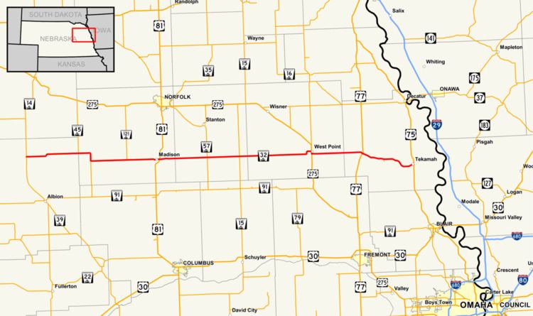
Nebraska Highway 32 is a United States highway in Nebraska. It runs for 101 miles (163 km) through east central and eastern Nebraska. Its western terminus is at Nebraska Highway 14 in Petersburg. Its eastern terminus is at U.S. Highway 75 in Tekamah.
Contents
Map of NE-32, Nebraska, USA
Route description
Nebraska Highway 32 begins in Petersburg at Nebraska Highway 14. It goes east from there through farmland and at the border separating Boone County and Madison County, it meets Nebraska Highway 45. They overlap for 5 miles (8.0 km), then NE 32 turns east near Newman Grove. It turns east, meets Nebraska Highway 121, then enters Madison. At the east end of Madison, NE 32 meets U.S. Highway 81. It continues east to West Point, Nebraska, meeting Nebraska Highway 57 and Nebraska Highway 15 between Madison and West Point. At West Point, NE 32 meets U.S. Highway 275 and they overlap in West Point. After separating from US 275, NE 32 turns east again and meets U.S. Highway 77 near Oakland. It continues east again and ends in Tekamah at U.S. Highway 75.