
Country United States FIPS code 31-52575 Elevation 411 m Population 3,310 (2013) Area code 402 | Time zone Central (CST) (UTC-6) GNIS feature ID 0834614 Zip code 68788 Local time Friday 9:34 PM | |
 | ||
Weather 7°C, Wind NE at 3 km/h, 76% Humidity Area 7.071 km² (7.045 km² Land / 3 ha Water) | ||
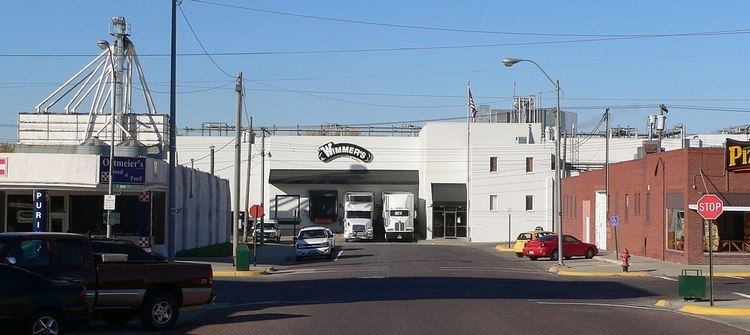
West Point is a city in and the county seat of Cuming County, Nebraska, United States. The population was 3,364 at the 2010 census.
Contents
Map of West Point, NE 68788, USA
History
West Point was first founded in the spring of 1857, when Omaha businessmen formed the Nebraska Settlement Association in order to find suitable townsites in the Elkhorn Valley. Uriah, John, and Andrew Bruner (three brothers originally from Pennsylvania), and William Sexauer chose the present location on a bend along a river, which they called New Philadelphia. The name was soon changed to West Point because it was the westernmost outpost along the valley.
West Point became the county seat of Cuming County on October 12, 1858 after winning the election over the community of DeWitt. A total of 19 votes were split between the two towns with West Point obtaining 12 votes. By the spring of 1859, over 4,000 Pawnee natives flooded the Elkhorn Valley during a hunting excursion and, displeased to find white settlers in the valley, burned several homesteads and killed livestock. The so-called Pawnee War ended near Battle Creek without a fight.
West Point grew slowly at first, but with the coming of the railroad in 1870, it boomed to a population of over 700.
Geography
West Point is located at 41°50′23″N 96°42′41″W (41.839635, -96.711406).
According to the United States Census Bureau, the city has a total area of 2.73 square miles (7.07 km2), of which 2.72 square miles (7.04 km2) is land and 0.01 square miles (0.03 km2) is water. West Point lies on the eastern bank of the Elkhorn River.
2010 census
As of the census of 2010, there were 3,364 people, 1,432 households, and 899 families residing in the city. The population density was 1,236.8 inhabitants per square mile (477.5/km2). There were 1,580 housing units at an average density of 580.9 per square mile (224.3/km2). The racial makeup of the city was 87.7% White, 0.3% African American, 0.4% Native American, 0.3% Asian, 0.1% Pacific Islander, 10.3% from other races, and 1.0% from two or more races. Hispanic or Latino of any race were 16.8% of the population.
There were 1,432 households of which 27.4% had children under the age of 18 living with them, 52.0% were married couples living together, 7.3% had a female householder with no husband present, 3.5% had a male householder with no wife present, and 37.2% were non-families. 34.1% of all households were made up of individuals and 19.4% had someone living alone who was 65 years of age or older. The average household size was 2.31 and the average family size was 2.97.
The median age in the city was 43.2 years. 25.5% of residents were under the age of 18; 5.4% were between the ages of 18 and 24; 20.9% were from 25 to 44; 25.6% were from 45 to 64; and 22.6% were 65 years of age or older. The gender makeup of the city was 48.1% male and 51.9% female.
2000 census
As of the census of 2000, there were 3,660 people, 1,432 households, and 946 families residing in the city. The population density was 1,479.2 people per square mile (572.1/km²). There were 1,552 housing units at an average density of 627.3 per square mile (242.6/km²). The racial makeup of the city was 92.02% White, 0.22% African American, 0.41% Native American, 0.16% Asian, 5.74% from other races, and 1.45% from two or more races. Hispanic or Latino of any race were 12.02% of the population.
There were 1,432 households out of which 30.7% had children under the age of 18 living with them, 56.7% were married couples living together, 6.7% had a female householder with no husband present, and 33.9% were non-families. 30.2% of all households were made up of individuals and 18.1% had someone living alone who was 65 years of age or older. The average household size was 2.45 and the average family size was 3.04.
In the city, the population was spread out with 25.1% under the age of 18, 7.0% from 18 to 24, 25.0% from 25 to 44, 19.6% from 45 to 64, and 23.2% who were 65 years of age or older. The median age was 40 years. For every 100 females there were 96.8 males. For every 100 females age 18 and over, there were 92.3 males.
As of 2000 the median income for a household in the city was $32,616, and the median income for a family was $38,702. Males had a median income of $27,981 versus $20,774 for females. The per capita income for the city was $19,053. About 5.4% of families and 9.0% of the population were below the poverty line, including 8.9% of those under age 18 and 6.8% of those age 65 or over.