
Existed: 1933 – present Length 143.6 km | Constructed 1933 | |
 | ||
Counties Valley County, Nebraska, Greeley County, Nebraska | ||
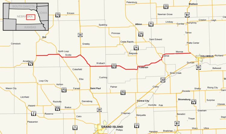
Nebraska Highway 22 is a highway in central Nebraska. It runs east–west for 89.25 miles (143.63 km). Its western terminus is at Nebraska Highway 70 south of Ord. Its eastern terminus is at U.S. Highway 81 northwest of Columbus.
Contents
Map of NE-22, Nebraska, USA
Route description
Nebraska Highway 22 begins at Nebraska Highway 70 south of Ord in rural Valley County, heading east into farmland. At North Loup, NE 22 meets Nebraska Highway 11 and they are paired together for 2 miles (3.2 km). Near Scotia, it turns east and goes through Scotia before meeting U.S. Highway 281. The two highways are paired together and separate near Wolbach. It goes east through Wolbach and continues east until it meets Nebraska Highway 14 in Fullerton. NE 22 and NE 14 go north out of Fullerton and separate. NE 22 then goes east on an alignment which parallels the Loup River on its north side. It passes through Genoa and Monroe before ending at U.S. Highway 81 near Columbus.