
Employees 23 | ||
 | ||
Jurisdiction Federal Government of the United States Agency executives Suzanne Fortin, Meteorologist in ChargeChance Hayes, Warning Coordination Meteorologist Parent agency | ||
The National Weather Service Wichita, Kansas (NWS Wichita) is a local weather forecast office of the National Weather Service responsible for monitoring weather conditions for 26 counties in central, south-central, and southeastern Kansas, including the Wichita Metropolitan Area and Salina, Kansas.
Contents
History
The Army Signal Service established a federal weather office in the region on June 13, 1888. On April 1, 1930, the Wichita Municipal Airport (currently McConnell Air Force Base) weather office opened. Pilot Balloons were sent at 5:30 am and pm each day, and from April 1, 1930 to November 29, 1940 there were two Weather Bureau Offices in Wichita.
Present day
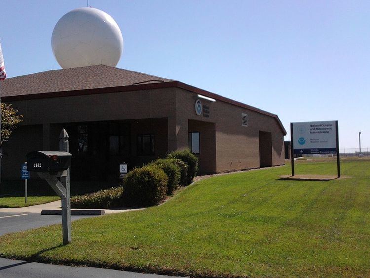
The current National Weather Service Wichita is located at 2142 S. Tyler Road in the southwestern part of Wichita, near Wichita Mid-Continent Airport, and is in charge of issuing local forecasts and weather warnings for central, south central, and southeastern Kansas. It is one of four National Weather Service offices located in Kansas and one of seven that serve the state. In the event that the office becomes temporarily unable to perform its duties, NWS Wichita's primary backup office (the office that would take over until NWS Wichita was able to resume service) is the National Weather Service office in Topeka, Kansas, with the secondary backup office being the National Weather Service office in Dodge City, Kansas.
NOAA Weather Radio
NWS Wichita operates six NOAA Weather Radio transmitters to serve Central, South-Central and Southeast Kansas:
N.B. Counties marked with a § are outside the Wichita WFO's County Warning Area.