
Founded February 13, 1867 Population 39,278 (2013) Unemployment rate 5.3% (Apr 2015) | Named for Samuel J. Crawford Area 1,541 km² | |
 | ||
Website CrawfordCountyKansas.org Points of interest Crawford State Park, Crawford State Fishing L, Crawford County Historical, Miners Hall Museum, Mined Land Wildlife A | ||
Crawford County (county code CR) is a county located in Southeast Kansas. As of the 2010 census, the county population was 39,134. Its county seat is Girard, and its most populous city is Pittsburg. The county was named in honor of Samuel J. Crawford, Governor of Kansas.
Contents
- Map of Crawford County KS USA
- Early history
- 19th century
- 21st century
- Geography
- Adjacent counties
- Demographics
- Law and government
- Unified school districts
- Private schools
- Higher education
- Libraries
- Townships
- Area Attractions
- References
Map of Crawford County, KS, USA
Located in the Osage Cuestas and Cherokee Lowlands, it lies halfway between Kansas City, Missouri and Tulsa, Oklahoma. Crawford County, and much of southeast Kansas, was founded on coal mining, the Pittsburg-Weir Coalfield being located here, and is still known for mining today. Pittsburg State University is located in Crawford County.
Early history
For many millennia, the Great Plains of North America was inhabited by nomadic Native Americans. From the 16th century to 18th century, the Kingdom of France claimed ownership of large parts of North America. In 1762, after the French and Indian War, France secretly ceded New France to Spain, per the Treaty of Fontainebleau.
19th century
In 1802, Spain returned most of the land to France, but keeping title to about 7,500 square miles. In 1803, most of the land for modern day Kansas was acquired by the United States from France as part of the 828,000 square mile Louisiana Purchase for 2.83 cents per acre.
In 1854, the Kansas Territory was organized, then in 1861 Kansas became the 34th U.S. state. In 1867, Crawford County was established. It is named for Samuel J. Crawford, who was the governor in office at the time of the county's establishment.
21st century
On Sunday, May 4, 2003, a strong and violent F4 tornado touched down in western Crawford County, several miles west of Frontenac at around 4:40 p.m. The tornado remained on the ground throughout Crawford County until it entered neighboring Barton County, Missouri—traveling a total of 35 miles (56 km) and ending near Liberal, Missouri. The towns of Ringo, Franklin, and Mulberry, all in Crawford County, were devastated. The tornado cut a path of destruction roughly one quarter mile wide. Several F4 and F5 tornadoes hit Kansas, Missouri, and several other states that day, including the Kansas City metropolitan area. Six deaths were reported in Kansas, and Governor Sebelius declared much of eastern and southeastern Kansas a disaster area, including Crawford County.
Geography
According to the U.S. Census Bureau, the county has a total area of 595 square miles (1,540 km2), of which 590 square miles (1,500 km2) is land and 5.3 square miles (14 km2) (0.9%) is water.
Adjacent counties
Demographics
The Pittsburg Micropolitan Statistical Area includes all of Crawford County.
As of the U.S. Census in 2000, there were 38,242 people, 15,504 households, and 9,441 families residing in the county. The population density was 64 people per square mile (25/km²). There were 17,221 housing units at an average density of 29 per square mile (11/km²). The racial makeup of the county was 93.29% White, 1.83% Black or African American, 0.94% Native American, 1.11% Asian, 0.09% Pacific Islander, 1.11% from other races, and 1.63% from two or more races. Hispanic or Latino of any race were 2.38% of the population. 23.5% were of German, 12.5% American, 10.4% English, 10.2% Irish and 8.6% Italian ancestry according to Census 2000.
There were 15,504 households out of which 28.50% had children under the age of 18 living with them, 47.90% were married couples living together, 9.30% had a female householder with no husband present, and 39.10% were non-families. 30.60% of all households were made up of individuals and 13.40% had someone living alone who was 65 years of age or older. The average household size was 2.35 and the average family size was 2.96.
In the county, the population was spread out with 22.90% under the age of 18, 16.40% from 18 to 24, 25.00% from 25 to 44, 20.20% from 45 to 64, and 15.50% who were 65 years of age or older. The median age was 34 years. For every 100 females there were 95.00 males. For every 100 females age 18 and over, there were 92.40 males.
The median income for a household in the county was $29,409, and the median income for a family was $40,582. Males had a median income of $27,881 versus $21,517 for females. The per capita income for the county was $16,245. About 9.40% of families and 16.00% of the population were below the poverty line, including 17.00% of those under age 18 and 10.30% of those age 65 or over.
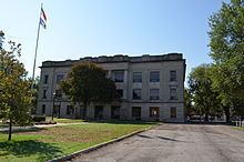
Law and government
Crawford County was a prohibition, or "dry", county until the Kansas Constitution was amended in 1986 and voters approved the sale of alcoholic liquor by the individual drink with a 30% food sales requirement. The food sales requirement was removed with voter approval in 1992.
Unified school districts
Private schools
Higher education
Libraries
Townships
Crawford County is divided into nine townships. The cities of Frontenac, Girard, Mulberry, and Pittsburg are considered governmentally independent and are excluded from the census figures for the townships. In the following table, the population center is the largest city (or cities) included in that township's population total, if it is of a significant size.