
Country United States County Ellsworth Time zone Central (CST) (UTC-6) Elevation 469 m Zip code 67439 | Incorporated 1867 Area code 785 Population 3,077 (2013) Mayor John Whitmer | |
 | ||
Weather 3°C, Wind NW at 5 km/h, 57% Humidity | ||
Ellsworth is a city in and the county seat of Ellsworth County, Kansas, United States. As of the 2010 census, the city population was 3,120. Known as a cow town in the 1870s, when the Kansas Pacific Railroad operated a stockyard here for shipping cattle to eastern markets, in the 21st century, it serves as the trading center of the rural county.
Contents
- Map of Ellsworth KS 67439 USA
- 19th century
- 21st century
- Geography
- Climate
- 2010 census
- 2000 census
- Government
- Education
- Media
- Infrastructure
- Notable people
- In popular culture
- References
Map of Ellsworth, KS 67439, USA
19th century
Once called "The Wickedest Cattletown in Kansas", the city is named for Fort Ellsworth, which was built in 1864. Due to speculation on imminent railroad construction, the population of Ellsworth boomed to over two thousand by the time it was incorporated in 1867. It has since been said, "Abilene, the first, Dodge City, the last, but Ellsworth the wickedest".
Ellsworth was a bustling cattle town for a time during the late 1860s, when the Kansas Pacific Railroad had a stop and stockyards there. Cattle were driven up from Texas to this point, and then shipped to major markets. Often cowboys had the run of the town. In 1875 Kansas Pacific closed its cattle pens, moving to another location. The cattle trade dwindled to almost nothing by the mid-1880s.
During the late 1860s into the 1870s, Ellsworth was known for being one of the "wickedest" cattle towns, the scene of numerous killings following shootouts between drunken cowboys. The town sported numerous saloons, brothels and gambling halls, with prostitution being rampant. Wild Bill Hickok ran for Ellsworth County Sheriff in 1868, but was defeated by veteran Union Army soldier E. W. Kingsbury. Kingsbury was an effective lawman, but relied on local marshals to patrol the town, as he also had to police the county. Violence in Ellsworth was commonplace among the cowboys and people associated with them. Ellsworth marshal Will Semans was shot and killed on September 26, 1869, while attempting to disarm a rowdy man in a dance hall.
For a time during this period, two small-time outlaws known only as Craig and Johnson began bullying people around the community, often committing armed robbery. After Semans' murder, they operated openly. Before long, citizens formed a vigilance squad and captured both men, hanging them in a lynching near the Smoky Hill River. Chauncey Whitney, a deputy to Kingsbury, took over following Sheriff Kingsbury's departure. Whitney quickly gained a reputation as being both tough and respectable, and was well liked. The scale of business is shown by construction of the Drovers Cottage in 1872. It could accommodate 175 guests, and stable 50 carriages and 100 horses.
Lawman Wyatt Earp served in Ellsworth for a short time. He later claimed to have arrested gunman Ben Thompson there. But Thompson was arrested by Deputy Ed Hogue after his brother Billy Thompson accidentally shot and killed Ellsworth County Sheriff Chauncey Whitney in 1873. Billy Thompson fled, fearing that he would be lynched for the death of the popular sheriff. Thompson was eventually captured and put on trial, but was acquitted in the shooting. Sheriff Whitney, a friend to both Thompsons, had told bystanders before his death that the shooting was an accident.
By the late 1870s the crime rate had dropped dramatically, as fewer cowboys came through after Kansas Pacific closed its stockyard here. Cattle drives were directed to other market cities, such as Dodge City and Abilene, Kansas. Ellsworth suffered economically.
21st century
Ellsworth has been developing heritage tourism related to its unique 19th-century history. The city and activists have plans to restore Ellsworth's Signature Insurance Building for use as the National Drovers Hall of Fame. Funds for the project are being raised party from an annual cattle drive down Main Street and Douglas Avenue; it is one of the few in the United States that is historically accurate.
Geography
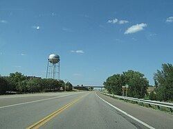
Ellsworth is located at 38°43′55″N 98°13′45″W (38.731924, -98.229204) at an elevation of 1,539 feet (469 m). The city lies on the north side of the Smoky Hill River in the Smoky Hills region of the Great Plains. Oak Creek, a tributary of the Smoky Hill, flows south past the eastern side of the city to its confluence with the river southeast of the city.
Ellsworth is located at the intersection of K-14, K-140, and K-156 in central Kansas roughly 27 miles (43 km) west-southwest of Salina, Kansas. Ellsworth is approximately 82 miles (132 km) northwest of Wichita and 192 miles (309 km) west-southwest of Kansas City. According to the United States Census Bureau, the city has a total area of 2.43 square miles (6.29 km2), all land.
Climate
Lying in the transition zone between North America's humid subtropical climate (Köppen Cfa) and humid continental climate (Köppen Dfa), Ellsworth experiences hot, humid summers and cold, dry winters. The average temperature is 53 °F (12 °C), and the average yearly precipitation is 27.3 inches (694 mm). Snowfall averages 16.7 inches (424 mm) per year. On average, July is the warmest month, January is the coldest month, and May is the wettest month. The hottest temperature recorded in Ellsworth was 117 °F (47 °C) in 1936; the coldest temperature recorded was -30 °F (-34 °C) in 1913.
2010 census
As of the census of 2010, there were 3,120 people, 997 households, and 639 families residing in the city. The population density was 1,284.0 inhabitants per square mile (495.8/km2). There were 1,154 housing units at an average density of 474.9 per square mile (183.4/km2). The racial makeup of the city was 87.9% White, 9.3% African American, 0.6% Native American, 0.4% Asian, 0.7% from other races, and 1.1% from two or more races. Hispanic or Latino of any race were 6.2% of the population.
There were 997 households of which 26.7% had children under the age of 18 living with them, 51.6% were married couples living together, 9.2% had a female householder with no husband present, 3.3% had a male householder with no wife present, and 35.9% were non-families. 32.7% of all households were made up of individuals and 12.9% had someone living alone who was 65 years of age or older. The average household size was 2.21 and the average family size was 2.77.
The median age in the city was 38.4 years. 17% of residents were under the age of 18; 10.5% were between the ages of 18 and 24; 31.5% were from 25 to 44; 25% were from 45 to 64; and 16.1% were 65 years of age or older. The gender makeup of the city was 61.9% male and 38.1% female.
2000 census
As of the census of 2000, there were 2,965 people, 995 households, and 641 families residing in the city. The population density was 1,413.3 people per square mile (545.1/km²). There were 1,141 housing units at an average density of 543.9 per square mile (209.8/km²). The racial makeup of the city was 88.40% White, 7.55% African American, 0.94% Native American, 0.51% Asian, 0.03% Pacific Islander, 0.94% from other races, and 1.62% from two or more races. Hispanic or Latino of any race were 3.95% of the population.
There were 995 households out of which 27.2% had children under the age of 18 living with them, 54.9% were married couples living together, 7.6% had a female householder with no husband present, and 35.5% were non-families. 33.6% of all households were made up of individuals and 18.4% had someone living alone who was 65 years of age or older. The average household size was 2.23 and the average family size was 2.84.
In the city, the population was spread out with 17.3% under the age of 18, 10.0% from 18 to 24, 31.5% from 25 to 44, 22.2% from 45 to 64, and 19.0% who were 65 years of age or older. The median age was 40 years. For every 100 females there were 132.2 males. For every 100 females age 18 and over, there were 139.9 males.
As of 2000 the median income for a household in the city was $35,625, and the median income for a family was $45,156. Males had a median income of $30,233 versus $19,762 for females. The per capita income for the city was $15,396. About 3.8% of families and 7.1% of the population were below the poverty line, including 9.0% of those under age 18 and 9.9% of those age 65 or over.
Government
The Ellsworth government consists of an elected mayor and five council members, who are also elected. The council meets the 2nd and 4th Monday of each month at 5:30PM.
Education
School unification consolidated Ellsworth, Geneseo and Kanopolis schools into USD 327. The district high school, Ellsworth Jr/Sr High School, is located in Ellsworth. The Ellsworth High School mascot is Ellsworth Bearcats.
Media
Ellsworth has a weekly newspaper, the Ellsworth County Independent/Reporter.
K243AR, a translator of radio station KRSL in Russell, Kansas, broadcasts from Ellsworth on 96.5 FM playing a Christian format.
Infrastructure
In 2008, TradeWind Energy and Enel North America made Ellsworth and Lincoln counties home to the Smoky Hills Wind Farm. Its 155 wind turbines have a total capacity of 250MW and are installed on approximately 20,000 acres of agricultural land. Some 100 landowners have lease arrangements to have the Smoky Hills Wind Farm’s turbines installed on their properties. The wind farm generates enough power to satisfy energy consumption requirements of 85,000 homes.