
Population 8,390 (2015 est) Mayor Erika Vickery Founded 1998 | Established 1998 Area 4,517 km² | |
 | ||
Points of interest The Sheep's Back Mus, Blanche Cave, Bool Lagoon Game Re, Naracoorte Historical Precinct, Mullinger Swamp Conserva | ||
Naracoorte lucindale council
The Naracoorte Lucindale Council is a local government area located inland from the Limestone Coast, adjacent to the Victorian border in south eastern South Australia.
Contents
- Naracoorte lucindale council
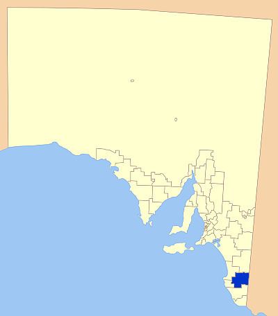
- Map of Naracoorte Lucindale SA Australia
- Geography
- Facilities
- Councillors
- References
Map of Naracoorte Lucindale, SA, Australia
It was created on 1 December 1998 following the amalgamation of the District Council of Naracoorte and the District Council of Lucindale.
The districts economy is agricultural based, with cereal crops, sheep and beef predominantly farmed. Naracoorte has a substantial tourist industry as well, with the Naracoorte Caves, Wonambi Fossil Centre and the seasonal Bool Lagoon Game Reserve Wetlands the main attractions.
Geography
The council encompasses the major towns of Naracoorte and Lucindale, as well as the smaller towns and localities of Binnum, Cadgee, Coles, Conmurra, Fox, Frances, Hynam, Joanna, Keppoch, Koppamurra, Kybybolite, Laurie Park, Lochaber, Mount Light, Moyhall, Spence, Stewart Range, Struan, The Gap, Wild Dog Valley, Woolumbool and Wrattonbully, and parts of Avenue Range and Bool Lagoon.
Facilities
The towns of Naracoorte and Lucindale collectively have all major facilities expected by visitors to the area, including supermarkets, specialty stores, restaurants and accommodation in a range of forms.
The district has a number of education and health facilities, with Naracoorte having a high school and 3 primary schools, a hospital, the Naracoorte Swimming Lake and Lucindale a public library and Area School.
The area also has a number of sporting clubs.
Councillors
Naracoorte Lucindale Council has a directly-elected mayor.