
Established 1998 Time zone ACST (UTC+9:30) Mean max temp Mean min temp Postal code 5273 | Postcode(s) 5273 Founded 1998 | |
 | ||
Avenue Range (formerly Downer) is a locality in the Australian state of South Australia located in the state's south-east within the Limestone Coast region about 265 kilometres (165 mi) south east of the Adelaide city centre.
Map of Avenue Range SA 5273, Australia
Its boundaries were created in 1998 for the “long established name” and includes the former Government Town of Avenue which was surveyed in 1885 and proclaimed as Downer. The town was renamed as Downer in 1940. Land within the locality is used exclusively for agriculture.
Avenue was a stop on the Kingston to Naracoorte railway which operated from 1876 until 1987. The Avenue school operated from 1903 until 1954.
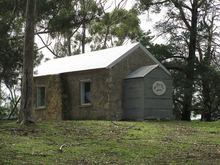
The locality includes the Cairnbank Homestead and Shearing Shed, which is listed on the South Australian Heritage Register.
Avenue Range is located within the federal Division of Barker, the state electoral district of MacKillop, and the local government areas of the Kingston District Council and the Naracoorte Lucindale Council.