
Postal code 65110 Area 58 km² Population 6,589 (2005) | Geocode 650507 Elevation 41 m Local time Monday 1:37 PM Province Phitsanulok Province | |
 | ||
Chief roadway Paved road leading to Route 1114 Weather 34°C, Wind SW at 10 km/h, 51% Humidity Amphoes Phitsanulok Province, Bang Krathum District | ||
Nakhon Pa Mak (Thai: นครป่าหมาก) is a rural subdistrict (tambon) in the Bang Krathum district of Phitsanulok Province, Thailand.
Contents
- Map of Nakhon Pa Mak Bang Krathum District Phitsanulok Thailand
- Etymology
- Geography
- History
- Administration
- Economy
- Education
- Settlements
- Temples
- Attractions
- References
Map of Nakhon Pa Mak, Bang Krathum District, Phitsanulok, Thailand
Etymology
The first element nakhon (Thai: นคร) means town or city. The second element pa (Thai: ป่า) means forest. The third element mak (Thai: หมาก) means betel palm. The name as a whole would be loosely translated as Betel Palm Forest City. Betel Palm are indeed indigenous to the area and inhabitants chew on the betel nuts which contain a natural stimulant, much like chewing tobacco.
Geography
Nakhon Pa Mak primarily consists of flat lowlands situated in the Nan Basin, which is part of the Chao Phraya Watershed. The Wang Thong River flows through Nakhon Pa Mak at the villages of Ban Sam Ruen and Bang Kranoi. Nakhon Pa Mak borders Tha Tan to the north-west, Mae Raka of Amphoe Wang Thong to the north-east, Wat Ta Yom to the east, Phai Lom to the south, and Bang Krathum to the west.
History
Originally named Sam Ruean (สามเรือน), it was renamed to Nakhon Pa Mak in 1939.
Administration
The subdistrict is subdivided into 13 smaller divisions called (muban), which roughly correspond to the villages within Nakhon Pa Mak. There are 8 villages, several of which occupy more than one muban. Nakhon Pa Mak is administrated by a Tambon administrative organization (TAO). The muban in Nakhon Pa Mak are enumerated as follows:
Economy
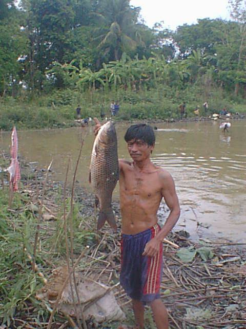
Nakhon Pa Mak's chief industry is farming, primarily rice, fish, cattle, coconuts and herbs. Villagers also grow fresh fruits including bananas and mangos. There are 40 retail businesses (stores and restaurants) in Nakhon Pa Mak, and 1 factory which processes sugar cane.
Education
Nakhon Pa Mak has four elementary schools (Bueng Lam School, Wat Rat Samosom School, Wat Grung See Jayrin School and Wat Laemphrathat School). Wat Rat Samoson School in Ban Sam Ruen was strictly an elementary school until around 1990, when an additional high school building was added. Prior to 1990, Nakhon Pa Mak children who wished to attend high school were required to utilize private transportation to the nearest high school in Ban Bang Krathum. There are no other high schools and no colleges or universities in Nakhon Pa Mak. There is also no school bus service.
Settlements
From most populated to least, the villages of Nakhon Pa Mak are: Ban Grong Greng (pop. 1881), Ban Sam Ruen (pop. 1340), Ban Bueng Lam (pop. 1050), Ban Dongphayom (pop. 678), Bang Kranoi (pop. 567), Ban Laemphrathat (pop. 565), Ban Gao (pop. 299) and Ban Laemkrok (pop. 209). From greatest land area to least, the villages rank as follows: Ban Grong Greng (20.9 km2), Ban Laemphrathat (10.4 km2), Ban Dongphayom (6.2 km2), Ban Bueng Lam (5.9 km2), Ban Sam Ruen (5.4 km2), Ban Bang Kranoi (4.4 km2), Ban Gao (2.8 km2) and Ban Laemkrok (1.8 km2).
Temples
A complete list of active temples in Nakhon Pa Mak is as follows:
All of the temples in Nakhon Pa Mak are of the Theravada Buddhist denomination.