
Postal code 65110 Population 7,021 (2005) Geocode 650505 | Time zone ICT (UTC+7) Local time Thursday 3:25 PM Province Phitsanulok Province | |
 | ||
Weather 36°C, Wind SW at 3 km/h, 44% Humidity Amphoes Phitsanulok Province, Bang Krathum District | ||
Tha Tan (Thai: ท่าตาล) is a sub-district (tambon) in the Bang Krathum District of Phitsanulok Province, Thailand.
Contents
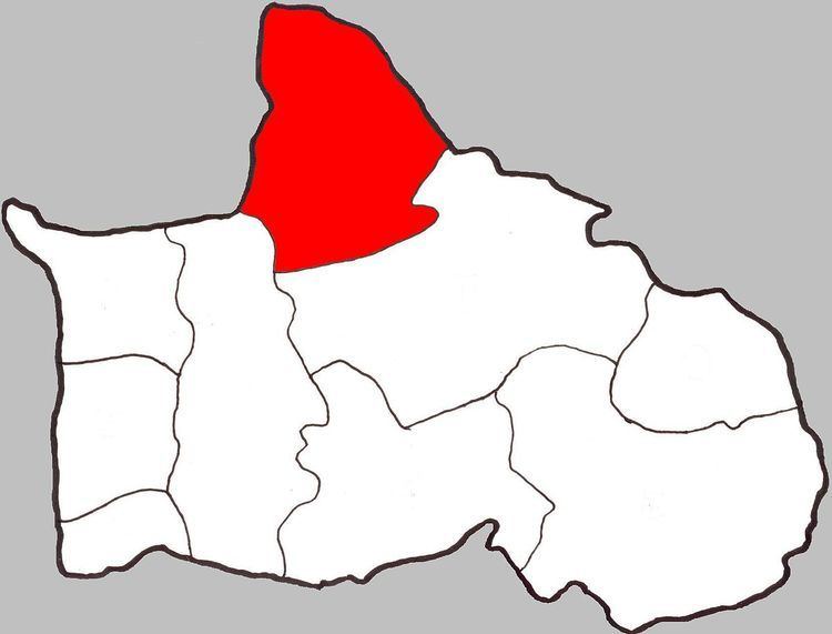
- Map of Tha Tan Bang Krathum District Phitsanulok 65110 Thailand
- Geography
- History
- Administration
- Temples
- References
Map of Tha Tan, Bang Krathum District, Phitsanulok 65110, Thailand
Geography
Tha Tan is the northernmost sub-district in Bang Krathum, bordering Wang Nam Khu of Amphoe Mueang Phitsanulok to the north-west, Amphoe Wang Thong to the north-east, Nakhon Pa Mak to the south and Bang Krathum to the south-west.
Tha Tan lies within the Nan Basin, which is part of the Chao Phraya Watershed. The Wang Thong River flows through the sub-district.
History
Originally named Bang Phi (บางผี), it was renamed Tha Tan in 1939.
Administration
The sub-district is subdivided into nine smaller divisions called (muban), which roughly correspond to the eight villages in Tha Tan. Tha Tan is administered by a tambon administrative organization (TAO). The muban in Tha Tan are enumerated as follows:
Temples
Tha Tan is home to the following eight temples: