
COSPAR ID 2009-005A Mission duration 2 years Launch date 6 February 2009 Inclination 98.97° Launch mass 1,440 kg | SATCAT no. 33591 Inclination 98.97° Period 1.7 hours Launch mass 1,440 kg | |
 | ||
Similar NOAA‑18, NOAA‑15, NOAA‑17, NOAA‑16, Suomi NPP | ||
NOAA-19, designated NOAA-N' (NOAA-N Prime) prior to launch, is the last of the United States National Oceanic and Atmospheric Administration's POES series of weather satellites (which was scheduled to be replaced by the next-generation NPOESS series before the NPOESS project was cancelled). NOAA-19 was launched on February 6, 2009.
Contents
Launch
On November 4, 2008, NASA announced that the satellite had arrived at Vandenberg aboard a C-5 Galaxy military transport aircraft. Installation of the payload fairing took place January 27, 2009; second stage propellant was loaded on 31 January.
Several attempts were made to conduct the launch. The first attempt was scrubbed after a failure was detected in a launch pad gaseous nitrogen pressurization system. The second attempt was scrubbed after the failure of a payload fairing air conditioning compressor, which is also part of the ground support equipment at the launch pad.
The satellite was successfully launched at about 2:22 a.m. PST. February 6, 2009 aboard a Delta II flying in the 7320 configuration from Vandenberg Air Force Base.
Instruments
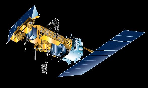
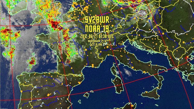
NOAA-N Prime carries a suite of instruments that provides data for weather and climate predictions. Like its predecessors, NOAA-N Prime provides global images of clouds and surface features and vertical profiles of atmospheric temperature and humidity for use in numerical weather and ocean forecast models, as well as data on ozone distribution in the upper part of the atmosphere, and near-Earth space environments—information important for the marine, aviation, power generation, agriculture, and other communities. The NOAA-N Prime primary instruments —the Advanced Very High Resolution Radiometer (AVHRR/3), High Resolution Infrared Radiation Sounder (HIRS/4), and the Advanced Microwave Sounding Unit (AMSU-A)—were all designed for a three-year mission. The Solar Backscatter Ultraviolet Spectral Radiometer (SBUV/2) was designed for a two-year mission, and the Microwave Humidity Sounder (MHS) was designed for a five-year mission.
Damage during manufacture
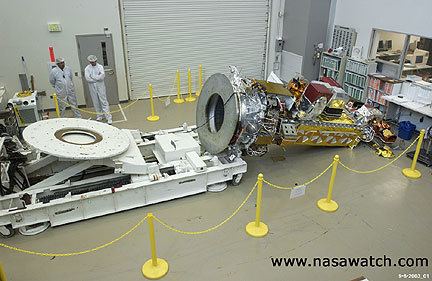
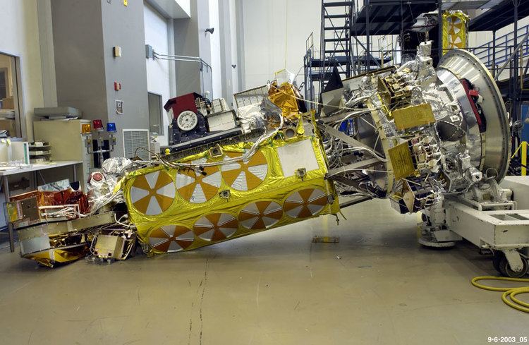
On September 6, 2003, the satellite was badly damaged while being worked on at the Lockheed Martin Space Systems factory in Sunnyvale, California. The satellite fell to the floor as a team was turning it into a horizontal position. A NASA inquiry into the mishap determined that it was caused by a lack of procedural discipline throughout the facility. While the turn-over cart used during the procedure was in storage, a technician removed twenty-four bolts securing an adapter plate to it without documenting the action. The team subsequently using the cart to turn the satellite failed to check the bolts, as specified in the procedure, before attempting to move the satellite. Repairs to the satellite cost $135 million. Lockheed Martin agreed to forfeit all profit from the project to help pay for repair costs; they later took a $30 million charge relating to the incident. The remainder of the repair costs were paid by the United States government.